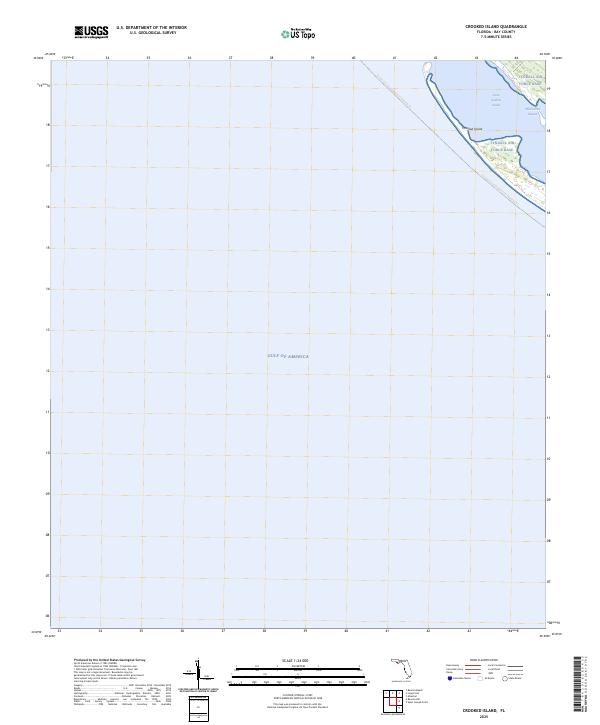
2025 Map of Crooked Island
USGS Topo · Published 2025About this map
Tyndall Air Force Base occupies the dominant terrestrial portion of this coastal survey, where military infrastructure meets the shifting sands of the Florida panhandle. The map captures a narrow barrier system defined by Crooked Island, separating the open Gulf of America from the protected waters of Saint Andrew Sound. This interface between land and sea is marked by intricate coastal features like Wild Goose Lagoon, illustrating the dynamic nature of the shoreline in Bay County. The inclusion of the Florida Circumnavigational Paddling Trail highlights the modern recreational use of these historic waters, providing a clear view of the navigational corridor between the mainland and the Gulf. Because the map is focused largely on the aquatic expanse, it serves as a precise record of the barrier island's configuration and the military's footprint on this strategic stretch of coast.
Find a feature on this map
6 named features on this map. Tap any name to fly to it.
Don’t see what you’re looking for? This feature index may not catch every label — zoom into the map to look around manually.
Map Details
Editions of this 2025 Crooked Island Map
This is the sole edition of this map. No revisions or reprints were ever made.
Other maps of this area

1943 · Beacon Beach
USGS Topo · 1:31,680

1943 · Crooked Island
USGS Topo · 1:31,680

1944 · Beacon Hill
USGS Topo · 1:31,680

1944 · Long Point
USGS Topo · 1:31,680

1945 · Allanton
USGS Topo · 1:31,680

1945 · St Joseph Point
USGS Topo · 1:31,680

1947 · Allanton
USGS Topo · 1:25,000

1949 · Apalachicola
USGS Topo · 1:250,000

1954 · Tallahassee
USGS Topo · 1:250,000
1956 · Beacon Hill
USGS Topo · 1:24,000