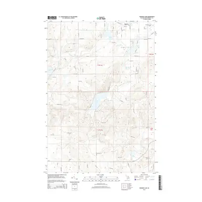
2014 Map of Crooked Lake
USGS Topo · Published 2014About this map
Avery Lake and the winding Thunder Bay River anchor this northern Michigan landscape, characterized by a dense concentration of glacial lakes and wetlands. The map shows the area as it appeared in 2014, with a mix of recreational water bodies and rural infrastructure. The northeastern corner contains the Atlanta Municipal Airport, serving the nearby community. Small residential developments are visible along the shores of Crooked Lake and Lake Fifteen, accessed by a network of local roads such as Sturgis Rd and Division St.
Find a feature on this map
85 named features on this map. Tap any name to fly to it.
Don’t see what you’re looking for? This feature index may not catch every label — zoom into the map to look around manually.
Map Details
Editions of this 2014 Crooked Lake Map
This is the sole edition of this map. No revisions or reprints were ever made.
Other maps of this area

1949 · Lewiston
USGS Topo · 1:62,500

1950 · Lewiston
USGS Topo · 1:24,000

1950 · Comstock Hills
USGS Topo · 1:24,000

1951 · Comstock Hills
USGS Topo · 1:24,000

1951 · Lewiston
USGS Topo · 1:24,000

1954 · Hetherton
USGS Topo · 1:62,500

1954 · Traverse City
USGS Topo · 1:250,000

1955 · Atlanta
USGS Topo · 1:62,500

1955 · Comins
USGS Topo · 1:62,500

1955 · Cheboygan
USGS Topo · 1:250,000