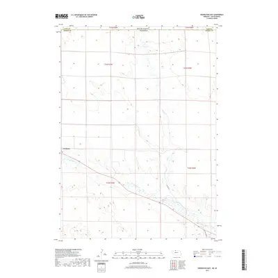
2017 Map of Crookston East
USGS Topo · Published 2017About this map
The village of Crookston serves as the primary settlement in this northern Nebraska landscape, situated near the winding course of Minnechaduza Cr. The terrain is defined by the drainage patterns of the Sandhills, where ephemeral watercourses like Dry Cr cut through the undulating prairie. Straddling the border between Cherry County, Nebraska, and Todd County, South Dakota, this area reflects the rural ranching character of the Great Plains. Evident of the local agricultural life are the informal routes such as Pasture Trl and the uniquely named One Trail Cowpath, which highlight the functional movement of livestock and land management across these vast sections in the early twenty-first century.
Find a feature on this map
12 named features on this map. Tap any name to fly to it.
Don’t see what you’re looking for? This feature index may not catch every label — zoom into the map to look around manually.
Map Details
Editions of this 2017 Crookston East Map
This is the sole edition of this map. No revisions or reprints were ever made.
Other maps of this area

1950 · Kilgore
USGS Topo · 1:62,500

1950 · Valentine
USGS Topo · 1:62,500

1955 · Martin
USGS Topo · 1:250,000

1957 · Valentine
USGS Topo · 1:250,000

1958 · Martin
USGS Topo · 1:250,000

1959 · Valentine
USGS Topo · 1:250,000

1969 · Olsonville SW
USGS Topo · 1:24,000

1969 · St. Francis SE
USGS Topo · 1:24,000

1982 · Olsonville SE
USGS Topo · 1:24,000

1982 · Mission
USGS Topo · 1:100,000