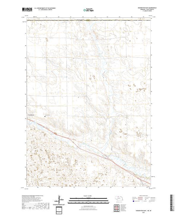
2021 Map of Crookston East
USGS Topo · Published 2021About this map
Crookston serves as the primary settlement on this northern Nebraska landscape, situated near the western edge of the quadrangle. The terrain is defined by the winding course of Minnechaduza Cr, which snakes across the southern half of the map, and the smaller Dry Cr that drains the northern section. This area of Cherry County is characterized by a sparse road network and expansive open land, with transportation routes like the Cowboy Trl following the creek valley. Genealogists and local historians can find the Crookston Cem located just east of the main town site. The map also documents the state boundary between South Dakota and Nebraska, as well as the transition into the neighboring Todd County. Unique local tracks like the One Trail Cowpath and Pasture Trl illustrate the rural, agricultural nature of the region in the early 21st century.
Find a feature on this map
14 named features on this map. Tap any name to fly to it.
Don’t see what you’re looking for? This feature index may not catch every label — zoom into the map to look around manually.
Map Details
Editions of this 2021 Crookston East Map
This is the sole edition of this map. No revisions or reprints were ever made.
Other maps of this area

1950 · Kilgore
USGS Topo · 1:62,500

1950 · Valentine
USGS Topo · 1:62,500

1955 · Martin
USGS Topo · 1:250,000

1957 · Valentine
USGS Topo · 1:250,000

1958 · Martin
USGS Topo · 1:250,000

1959 · Valentine
USGS Topo · 1:250,000

1969 · Olsonville SW
USGS Topo · 1:24,000

1969 · St. Francis SE
USGS Topo · 1:24,000

1982 · Olsonville SE
USGS Topo · 1:24,000

1982 · Mission
USGS Topo · 1:100,000