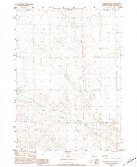
1983 Map of Crookston East
USGS Topo · Published 1984About this map
The Rosebud Indian Reservation occupies the northern portion of this landscape, where the state line divides the territory between South Dakota and Nebraska. Just south of this boundary, the settlement of Crookston serves as a local hub along the Chicago and North Western railroad line. The rail corridor follows the natural drainage of the region, specifically tracking the winding course of Minnechadua Creek as it moves through the sandy, undulating terrain. Other watercourses like Dry Creek and small, intermittent pools are scattered across the quadrangle, illustrating the complex hydrology of the High Plains. To the east of the main settlement, the name Jackson appears, marking a specific point along the transportation network in this corner of Cherry County. The map details a period when these rural transit lines remained central to the movement of goods and people across the state border.
Find a feature on this map
8 named features on this map. Tap any name to fly to it.
Don’t see what you’re looking for? This feature index may not catch every label — zoom into the map to look around manually.
Map Details
Editions of this 1983 Crookston East Map
This is the sole edition of this map. No revisions or reprints were ever made.
Other maps of this area

1950 · Kilgore
USGS Topo · 1:62,500

1950 · Valentine
USGS Topo · 1:62,500

1955 · Martin
USGS Topo · 1:250,000

1957 · Valentine
USGS Topo · 1:250,000

1958 · Martin
USGS Topo · 1:250,000

1959 · Valentine
USGS Topo · 1:250,000

1969 · Olsonville SW
USGS Topo · 1:24,000

1969 · St. Francis SE
USGS Topo · 1:24,000

1982 · Olsonville SE
USGS Topo · 1:24,000

1982 · Mission
USGS Topo · 1:100,000