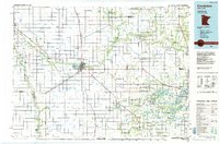
1984 Map of Crookston
USGS Topo · Published 1985About this map
The Red River Valley serves as the focal point for this mid-1980s look at Northwest Minnesota, where the Red River of the North forms the border with North Dakota. The landscape is defined by its extensive drainage network, including the Red Lake River and Sand Hill River, alongside numerous man-made structures like Judicial Ditch No 64 and Judicial Ditch No 15. The city of Crookston remains the regional hub, host to the University of Minnesota Technical College and a major intersection for the Burlington Northern Railroad and the Soo Line Railroad.
Find a feature on this map
162 named features on this map. Tap any name to fly to it.
Don’t see what you’re looking for? This feature index may not catch every label — zoom into the map to look around manually.
Map Details
Editions of this 1984 Crookston Map
2 editions found
Other maps of this area

1918 · Kelso
USGS Topo · 1:62,500

1918 · Angus
USGS Topo · 1:62,500

1918 · Hendrum
USGS Topo · 1:62,500

1918 · Twin Valley
USGS Topo · 1:62,500

1918 · Terrebonne
USGS Topo · 1:62,500

1918 · Red Lake Falls
USGS Topo · 1:62,500

1918 · Viking
USGS Topo · 1:62,500

1918 · Warren
USGS Topo · 1:62,500

1919 · Grit
USGS Topo · 1:62,500

1919 · Eldred
USGS Topo · 1:62,500