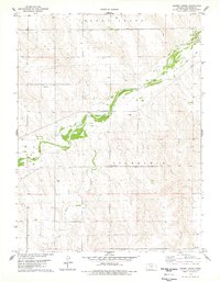
1978 Map of Crosby Creek
USGS Topo · Published 1978About this map
Cherry Creek and the Republican River converge in this high plains landscape of Cheyenne County, where the terrain transitions between agricultural uplands and the river valley. The 1970s landscape shows a sparse but established rural infrastructure, marked by landmarks like the Zion Cem in the northwest and the Battle Creek Cem situated near the intersection of local townships. Evidence of former transportation networks is preserved in the Old Railroad Grade that cuts across the northeastern corner, tracing a path toward the St. Francis State Game Management Area. The map reveals the intricate drainage patterns of smaller tributaries such as Crosby Creek and Battle Creek, alongside industrial features like the Sandpits found near the South Fork Republican River.
Find a feature on this map
13 named features on this map. Tap any name to fly to it.
Don’t see what you’re looking for? This feature index may not catch every label — zoom into the map to look around manually.
Map Details
Editions of this 1978 Crosby Creek Map
This is the sole edition of this map. No revisions or reprints were ever made.
Other maps of this area

1942 · St. Francis
USGS Topo · 1:62,500

1943 · St. Francis
USGS Topo · 1:62,500

1950 · Bonny Reservoir
USGS Topo · 1:62,500

1951 · St Francis
USGS Topo · 1:62,500

1952 · St Francis 3
USGS Topo · 1:62,500

1954 · Limon
USGS Topo · 1:250,000

1954 · Goodland
USGS Topo · 1:250,000

1956 · Goodland
USGS Topo · 1:250,000

1957 · Limon
USGS Topo · 1:250,000

1957 · Goodland
USGS Topo · 1:250,000