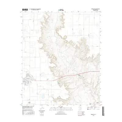
2016 Map of Crosbyton
USGS Topo · Published 2016About this map
Crosbyton serves as the focal point of this West Texas survey, where the organized grid of the town site meets the dramatic descent into the Caprock escarpment. The terrain is dominated by the deep incisions of Blanco Canyon, where the White River flows southward toward its confluence with Sand Rock Cr. This landscape is marked by unique hydrological features rarely seen in the High Plains, including Silver Falls and Twenty Foot Falls, alongside remote water sources like Couch Springs.
Find a feature on this map
62 named features on this map. Tap any name to fly to it.
Don’t see what you’re looking for? This feature index may not catch every label — zoom into the map to look around manually.
Map Details
Editions of this 2016 Crosbyton Map
This is the sole edition of this map. No revisions or reprints were ever made.
Other maps of this area

1954 · Lubbock
USGS Topo · 1:250,000

1961 · Bunker Hill
USGS Topo · 1:24,000

1965 · Floydada SE
USGS Topo · 1:24,000

1965 · Wake
USGS Topo · 1:24,000

1966 · Crosbyton
USGS Topo · 1:24,000

1966 · Mount Blanco
USGS Topo · 1:24,000

1966 · McAdoo
USGS Topo · 1:24,000

1966 · Collett Springs
USGS Topo · 1:24,000

1967 · Ralls SE
USGS Topo · 1:24,000

1967 · Ralls NE
USGS Topo · 1:24,000