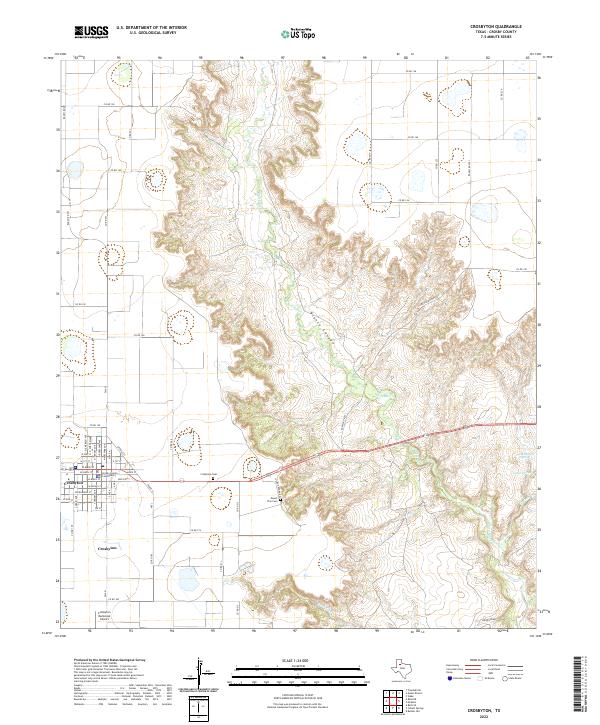
2022 Map of Crosbyton
USGS Topo · Published 2022About this map
The town of Crosbyton serves as the focal point for this survey of the Llano Estacado's eastern edge, where the flat plains give way to the dramatic relief of Blanco Canyon. Flowing through the center of the quadrangle, the White River carves a deep path punctuated by natural features like Silver Falls and Twenty Foot Falls. The transition from the grid-patterned agricultural roads of the high plains to the winding topography of the canyon is a defining characteristic of this West Texas landscape.
Find a feature on this map
63 named features on this map. Tap any name to fly to it.
Don’t see what you’re looking for? This feature index may not catch every label — zoom into the map to look around manually.
Map Details
Editions of this 2022 Crosbyton Map
This is the sole edition of this map. No revisions or reprints were ever made.
Other maps of this area

1954 · Lubbock
USGS Topo · 1:250,000

1961 · Bunker Hill
USGS Topo · 1:24,000

1965 · Floydada SE
USGS Topo · 1:24,000

1965 · Wake
USGS Topo · 1:24,000

1966 · Crosbyton
USGS Topo · 1:24,000

1966 · Mount Blanco
USGS Topo · 1:24,000

1966 · McAdoo
USGS Topo · 1:24,000

1966 · Collett Springs
USGS Topo · 1:24,000

1967 · Ralls SE
USGS Topo · 1:24,000

1967 · Ralls NE
USGS Topo · 1:24,000