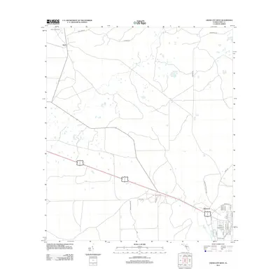
2012 Map of Cross City West
USGS Topo · Published 2012About this map
The settlement of Hines and the surrounding pine flatwoods of Dixie County characterize this survey, where the terrestrial landscape is defined by its timber and wildlife heritage. The Steinhatchee Wildlife Area occupies the eastern portion of the quadrangle, bordering the edges of the township. A network of rural routes, including Hines Tram Rd and Perry Valentine Rd, reveals the historical reliance on transport corridors for local industry. Evidence of forestry management and surveillance is visible at the Hines Lookout Tower in the northwest corner. Near the southern boundary, the residential street grid includes names like Estelle Blvd and Kressman St, marking the edge of local development as it transitions into the expansive wetlands and timberlands typical of this Gulf Coast region.
Find a feature on this map
31 named features on this map. Tap any name to fly to it.
Don’t see what you’re looking for? This feature index may not catch every label — zoom into the map to look around manually.
Map Details
Editions of this 2012 Cross City West Map
This is the sole edition of this map. No revisions or reprints were ever made.
Other maps of this area

1954 · Cross City West
USGS Topo · 1:24,000

1954 · Eugene
USGS Topo · 1:24,000

1954 · Clara
USGS Topo · 1:24,000

1954 · Cross City East
USGS Topo · 1:24,000

1954 · Mallory Swamp SW
USGS Topo · 1:24,000

1954 · Jena
USGS Topo · 1:24,000

1954 · Steinhatchee SE
USGS Topo · 1:24,000

1954 · Mallory Swamp SE
USGS Topo · 1:24,000

1954 · Cross City SW
USGS Topo · 1:24,000

1954 · Gainesville
USGS Topo · 1:250,000