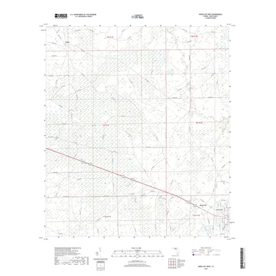
2018 Map of Cross City West
USGS Topo · Published 2018About this map
Hines and the surrounding pine-rich lowlands of Dixie County are documented in this 2018 survey, reflecting a landscape long defined by timbering and agricultural access. The northern portion of the map is dominated by the geometric intersection of rural routes like Hines Tram Rd and W Swamp Rd, names that recall the historic tramways used for logging throughout the Florida Panhandle. Moving southeast toward the corner of the quadrangle, the settlement of Shamrock appears just west of the county seat at Cross City. The area is characterized by a dense grid of numbered roads, such as Co Rd 358 and Nw 357 Hwy, which navigate the wetlands and timber stands of the Suwannee River Valley region. This survey captures the rural infrastructure and land divisions that persist in this corner of the state, away from the more developed coastal or metropolitan centers.
Find a feature on this map
96 named features on this map. Tap any name to fly to it.
Don’t see what you’re looking for? This feature index may not catch every label — zoom into the map to look around manually.
Map Details
Editions of this 2018 Cross City West Map
This is the sole edition of this map. No revisions or reprints were ever made.
Other maps of this area

1954 · Cross City West
USGS Topo · 1:24,000

1954 · Eugene
USGS Topo · 1:24,000

1954 · Clara
USGS Topo · 1:24,000

1954 · Cross City East
USGS Topo · 1:24,000

1954 · Mallory Swamp SW
USGS Topo · 1:24,000

1954 · Jena
USGS Topo · 1:24,000

1954 · Steinhatchee SE
USGS Topo · 1:24,000

1954 · Mallory Swamp SE
USGS Topo · 1:24,000

1954 · Cross City SW
USGS Topo · 1:24,000

1954 · Gainesville
USGS Topo · 1:250,000