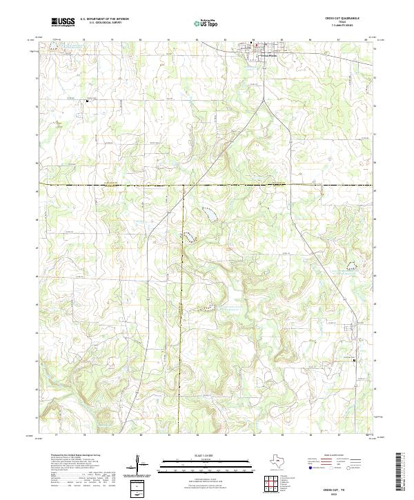
2022 Map of Cross Cut
USGS Topo · Published 2022About this map
The northern edge of the Coleman and Brown County line is anchored by the community of Cross Plains, where a grid of streets like W 1st St and Fisher St surrounds the Cross Plains Memorial Park. This rural landscape is defined by its water management systems, notably the numerous large impoundments including the Soil Conservation Service Site 22 Reservoir and McDonough Lake. Moving south toward Rocky Oaks, the terrain is carved by the drainages of Turkey Creek and Dooley Creek, which eventually feed into the broader basin of Pecan Bayou. Local history researchers will find several well-placed landmarks, from the Dressy Cemetery in the northwest to the Cross Cut Cemetery in the southeast, providing clear markers for family homesteads situated among the winding county roads.
Find a feature on this map
50 named features on this map. Tap any name to fly to it.
Don’t see what you’re looking for? This feature index may not catch every label — zoom into the map to look around manually.
Map Details
Editions of this 2022 Cross Cut Map
This is the sole edition of this map. No revisions or reprints were ever made.
Other maps of this area

1887 · Coleman
USGS Topo · 1:125,000

1889 · Coleman
USGS Topo · 1:125,000

1924 · Coleman 1-a
USGS Topo · 1:48,000

1924 · Brownwood Reservoir Site
USGS Topo · 1:48,000

1927 · Grosvenor
USGS Topo · 1:62,500

1931 · Baird
USGS Topo · 1:125,000

1932 · Baird
USGS Topo · 1:125,000

1954 · Brownwood
USGS Topo · 1:250,000

1954 · Abilene
USGS Topo · 1:250,000

1958 · Abilene
USGS Topo · 1:250,000