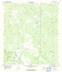
1969 Map of Cross NE
USGS Topo · Published 1972About this map
The boundary between Atascosa and McMullen counties cuts across this late-1960s landscape, which is defined by an intricate network of ranching infrastructure and intermittent watercourses. Large-scale ranching operations are evidenced by numerous named water tanks and windmills, such as Sacatosa Tank, Strickland Tank, and Vat Tank, which supported livestock in this brush-country environment. The terrain is drained by several significant creek systems, most notably Macho Creek and San Miguel Creek, which weave through the south-central Texas plains. The presence of Javelina Tank and Brahma Tank reflects the local wildlife and cattle breeds essential to the area's identity. Fine dashed lines on the survey indicate selected fence lines, providing genealogists and land historians a rare look at property divisions and range management during this era.
Find a feature on this map
24 named features on this map. Tap any name to fly to it.
Don’t see what you’re looking for? This feature index may not catch every label — zoom into the map to look around manually.
Map Details
Editions of this 1969 Cross NE Map
2 editions found
Other maps of this area

1925 · Crowther No. 3
USGS Topo · 1:48,000

1930 · Whitsett
USGS Topo · 1:62,500

1942 · Whitsett
USGS Topo · 1:62,500

1953 · Crystal City
USGS Topo · 1:250,000

1955 · Crystal City
USGS Topo · 1:250,000

1956 · Pleasanton
USGS Topo · 1:62,500

1956 · Jourdanton
USGS Topo · 1:62,500

1956 · Franklin Settlement
USGS Topo · 1:62,500

1961 · Crystal City
USGS Topo · 1:250,000
1965 · Caballos Creek
USGS Topo · 1:24,000