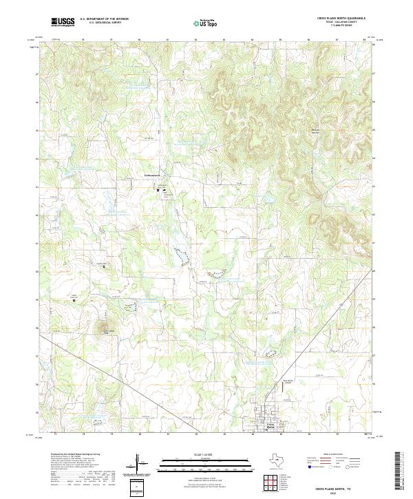
2022 Map of Cross Plains North
USGS Topo · Published 2022About this map
Cottonwood and the northern reaches of Cross Plains define this West Texas landscape, where the rolling plains meet the headwaters of several critical drainages. The area is marked by a sophisticated water management system, featuring numerous structures like Soil Conservation Service Site 4 Reservoir and Soil Conservation Service Site 7 Reservoir designed to control runoff into Cottonwood Cr and Turkey Cr. Local history is anchored by a series of family and community landmarks, including Old Cottonwood Cem and Oglesby Cem. Distinctive terrain features such as Mexican Hat Hill, Caddo Peak, and East Caddo Peak rise above the ranching and agricultural lands, providing natural orientation points in the north-central Texas backcountry.
Find a feature on this map
71 named features on this map. Tap any name to fly to it.
Don’t see what you’re looking for? This feature index may not catch every label — zoom into the map to look around manually.
Map Details
Editions of this 2022 Cross Plains North Map
This is the sole edition of this map. No revisions or reprints were ever made.
Other maps of this area

1931 · Baird
USGS Topo · 1:125,000

1932 · Baird
USGS Topo · 1:125,000

1954 · Abilene
USGS Topo · 1:250,000

1958 · Abilene
USGS Topo · 1:250,000
1960 · Cross Cut
USGS Topo · 1:24,000
1960 · Webbville
USGS Topo · 1:24,000

1966 · Scranton
USGS Topo · 1:24,000

1966 · Putnam South
USGS Topo · 1:24,000

1966 · Admiral
USGS Topo · 1:24,000
1968 · Rowden
USGS Topo · 1:24,000