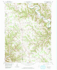
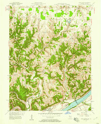
1959 Map of Cross Plains
USGS Topo · Published 1960About this map
Cross Plains and the surrounding rural uplands of Ripley County are defined by a complex network of deep creek valleys and high ridges in this 1959 survey. The settlement of Friendship sits tucked into the valley of Laughery Creek, while the broader landscape is dotted with ancestral markers including Wesley Chapel and St Pauls Ch. The topography reveals the distinctive Devils Backbone ridge, carved by the Wilson Fork and Devils Backbone Branch, illustrating the sharp transition between flat agricultural plateaus and the eroded drainage basins that feed into the larger river systems. Genealogists will find a wealth of family-named landmarks and cemeteries, such as the Winkler Cem, Nickolson Cem, and Arford Cem, which indicate the established family farmsteads of the mid-20th century. Smaller communities like Olean, Benham, and Avonburg are connected by winding roads that follow the high ground of Salem Ridge and Trot Ridge.
Find a feature on this map
65 named features on this map. Tap any name to fly to it.
Don’t see what you’re looking for? This feature index may not catch every label — zoom into the map to look around manually.
Map Details
Editions of this 1959 Cross Plains Map
4 editions found
Other maps of this area

1943 · Vevay North
USGS Topo · 1:24,000

1946 · Versailles
USGS Topo · 1:24,000

1946 · Milan
USGS Topo · 1:24,000

1953 · Cincinnati
USGS Topo · 1:250,000

1956 · Bennington
USGS Topo · 1:24,000

1956 · Canaan
USGS Topo · 1:24,000

1956 · Louisville
USGS Topo · 1:250,000

1957 · Cincinnati
USGS Topo · 1:250,000
1957 · Vevay North
USGS Topo · 1:24,000

1958 · Dillsboro
USGS Topo · 1:24,000