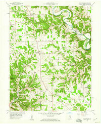
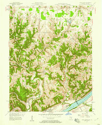
1959 Map of Cross Plains
USGS Topo · Published 1973About this map
Laughery Creek and its many winding tributaries define the rural landscape of southeastern Indiana at the close of the 1950s. The region is dotted with family cemeteries and small rural churches, including Wesley Chapel and the Concord Ch, indicating a deeply rooted community structure. In the town of Friendship, the topography is dominated by the steep ridges of Trot Ridge Creek and Bear Creek, while the settlement of Cross Plains sits on higher ground at the intersection of several local routes. Genealogists will find a wealth of data in the numerous burial grounds like Akers Cem, Nickolson Cem, and Beebe Cem. The landscape reflects a traditional agrarian economy, evidenced by the Township Sch and a local Quarry, with natural features like the Backbone ridge providing prominent landmarks for those studying the physical history of Brown and Pleasant townships.
Find a feature on this map
66 named features on this map. Tap any name to fly to it.
Don’t see what you’re looking for? This feature index may not catch every label — zoom into the map to look around manually.
Map Details
Editions of this 1959 Cross Plains Map
4 editions found
Other maps of this area

1943 · Vevay North
USGS Topo · 1:24,000

1946 · Versailles
USGS Topo · 1:24,000

1946 · Milan
USGS Topo · 1:24,000

1953 · Cincinnati
USGS Topo · 1:250,000

1956 · Bennington
USGS Topo · 1:24,000

1956 · Canaan
USGS Topo · 1:24,000

1956 · Louisville
USGS Topo · 1:250,000

1957 · Cincinnati
USGS Topo · 1:250,000
1957 · Vevay North
USGS Topo · 1:24,000

1958 · Dillsboro
USGS Topo · 1:24,000