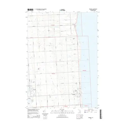
2014 Map of Croswell
USGS Topo · Published 2014About this map
Croswell and Lexington anchor this eastern Sanilac County landscape, situated along the shoreline of Lake Huron. The interior is defined by a dense network of country roads following the Public Land Survey System grid, with major routes like M-90 and Lakeshore Rd connecting the coastal settlements to the agricultural hinterland. The Black River winds through the western portion of the map, crossed by the Harrington Bridge. This area is particularly dense with historical markers for genealogists, featuring an unusually high concentration of small burial grounds such as Old Ridge Cem, Hoppenworth Cem, and Wixson Cem. These sites, along with smaller waterways like Pine Hill Stream and Mill Cr, provide a clear picture of the longstanding rural settlement patterns in Michigan's Thumb region.
Find a feature on this map
57 named features on this map. Tap any name to fly to it.
Don’t see what you’re looking for? This feature index may not catch every label — zoom into the map to look around manually.
Map Details
Editions of this 2014 Croswell Map
This is the sole edition of this map. No revisions or reprints were ever made.
Other maps of this area

1954 · Flint
USGS Topo · 1:250,000

1958 · Flint
USGS Topo · 1:250,000

1961 · Roseburg
USGS Topo · 1:24,000
1961 · Jeddo
USGS Topo · 1:24,000

1963 · Croswell
USGS Topo · 1:24,000

1963 · Port Sanilac
USGS Topo · 1:24,000

1963 · Applegate
USGS Topo · 1:24,000
1963 · Carsonville
USGS Topo · 1:24,000

1984 · Croswell
USGS Topo · 1:100,000
2011 · Jeddo OE E
USGS Topo · 1:24,000