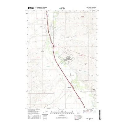
2017 Map of Crow Agency
USGS Topo · Published 2017About this map
The Little Bighorn Battlefield National Monument dominates this Montana landscape, preserving the terrain of the 1876 conflict. Every topographical detail is documented, from the high ground of Last Stand Hill and Greasy Grass Ridge to the steep Deep Ravine and Calhoun Hill. The map meticulously labels these tactical landmarks alongside the Custer National Cem, providing a precise spatial context for the historic engagement between the U.S. Army and the Lakota, Cheyenne, and Arapaho.
Find a feature on this map
55 named features on this map. Tap any name to fly to it.
Don’t see what you’re looking for? This feature index may not catch every label — zoom into the map to look around manually.
Map Details
Editions of this 2017 Crow Agency Map
This is the sole edition of this map. No revisions or reprints were ever made.
Other maps of this area

1894 · Rosebud
USGS Topo · 1:125,000

1894 · St. Xavier
USGS Topo · 1:125,000

1894 · Fort Custer
USGS Topo · 1:125,000

1901 · Rosebud
USGS Topo · 1:125,000

1901 · St. Xavier
USGS Topo · 1:125,000

1954 · Hardin
USGS Topo · 1:250,000

1957 · Hardin
USGS Topo · 1:250,000

1958 · Hardin
USGS Topo · 1:250,000

1960 · St Xavier NE
USGS Topo · 1:24,000

1960 · Hardin
USGS Topo · 1:24,000