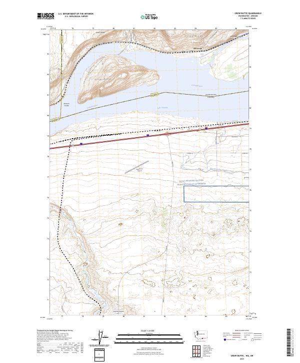
2023 Map of Crow Butte
USGS Topo · Published 2023About this map
The Columbia River defines this stretch of the Pacific Northwest, where the waters of Lake Umatilla separate Washington and Oregon. Much of the northern shoreline is dominated by the Umatilla National Wildlife Refuge, protecting riparian habitats around Crow Butte and Whitcomb Island. The landscape is a study in agricultural and military land use; large-scale circles of irrigated farmland, such as those reached by 100 Circle Farms Rd, sit adjacent to the sprawling Naval Weapons Systems Training Facility Boardman. Transport and infrastructure are vital to the area's character, evidenced by the West Extension Irrigation Canal and the Boardman Airport located south of the river. The terrain transitions from the river valley into geological features like Canoe Ridge and Artesian Coulee, reflecting a region defined by water management and federal land stewardship.
Find a feature on this map
31 named features on this map. Tap any name to fly to it.
Don’t see what you’re looking for? This feature index may not catch every label — zoom into the map to look around manually.
Map Details
Editions of this 2023 Crow Butte Map
This is the sole edition of this map. No revisions or reprints were ever made.
Other maps of this area

1906 · Blalock Island
USGS Topo · 1:125,000

1908 · Blalock Island
USGS Topo · 1:125,000

1953 · Pendleton
USGS Topo · 1:250,000

1956 · Pendleton
USGS Topo · 1:250,000
1962 · Phinny Hill
USGS Topo · 1:24,000

1962 · Canoe Ridge
USGS Topo · 1:24,000

1962 · Alderdale
USGS Topo · 1:24,000

1962 · Blalock Island
USGS Topo · 1:24,000

1962 · Boardman
USGS Topo · 1:24,000

1962 · Crow Butte
USGS Topo · 1:24,000