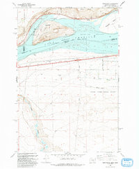
1993 Map of Crow Butte
USGS Topo · Published 1993About this map
Crow Butte and Whitcomb Island dominate the landscape of the Columbia River in this 1993 revision, which captures the intersection of recreation, agriculture, and military activity along the Washington-Oregon border. The area is defined by the expanse of Lake Columbia, where Crow Butte State Park offers public access via boat ramps and a campground. To the east, the Umatilla National Wildlife Refuge preserves the riverine habitat near the settlement of Whitcomb.
Find a feature on this map
31 named features on this map. Tap any name to fly to it.
Don’t see what you’re looking for? This feature index may not catch every label — zoom into the map to look around manually.
Map Details
Editions of this 1993 Crow Butte Map
This is the sole edition of this map. No revisions or reprints were ever made.
Other maps of this area

1906 · Blalock Island
USGS Topo · 1:125,000

1908 · Blalock Island
USGS Topo · 1:125,000

1953 · Pendleton
USGS Topo · 1:250,000

1956 · Pendleton
USGS Topo · 1:250,000
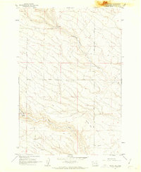
1962 · Phinny Hill
USGS Topo · 1:24,000

1962 · Canoe Ridge
USGS Topo · 1:24,000

1962 · Alderdale
USGS Topo · 1:24,000

1962 · Blalock Island
USGS Topo · 1:24,000

1962 · Boardman
USGS Topo · 1:24,000

1962 · Crow Butte
USGS Topo · 1:24,000