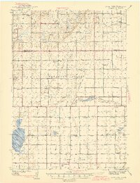
1942 Map of Crow Lake
USGS Topo · Published 1942About this map
The rolling plains of South Dakota are defined by a dense network of local schools and vital water sources in this mid-century survey. Named townships like Pleasant Valley and Firesteel reveal a settled landscape reliant on Artesian Wells and the drainage of Firesteel Creek. The map provides significant detail for genealogists, identifying numerous country schools including Sefria Sch, Beckman Sch, and Whittier Sch, which served as the social heart for far-flung farming families. Community gathering points are clearly marked, such as the Farmers Union Hall and Township Hall, illustrating the civic structure of the era.
Find a feature on this map
48 named features on this map. Tap any name to fly to it.
Don’t see what you’re looking for? This feature index may not catch every label — zoom into the map to look around manually.
Map Details
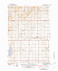
Editions of this 1942 Crow Lake Map
3 editions found
Other maps of this area

1898 · Huron
USGS Topo · 1:125,000

1899 · Mitchell
USGS Topo · 1:125,000

1941 · Kimball North
USGS Topo · 1:62,500

1942 · Crow Lake
USGS Topo · 1:62,500

1951 · Kimball North
USGS Topo · 1:62,500

1953 · Huron
USGS Topo · 1:250,000

1954 · Huron
USGS Topo · 1:250,000

1955 · Mitchell
USGS Topo · 1:250,000

1959 · Mitchell
USGS Topo · 1:250,000

1973 · Wessington Springs
USGS Topo · 1:24,000