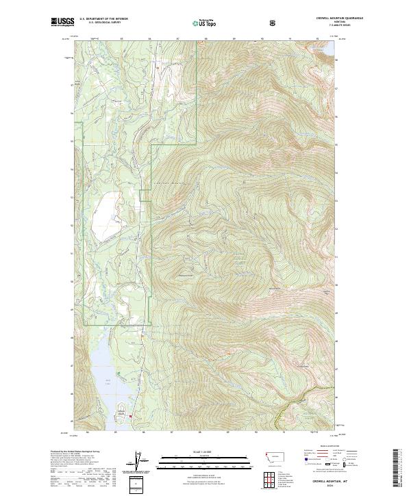
2024 Map of Crowell Mountain
USGS Topo · Published 2024About this map
The Cabinet Mountains Wilderness dominates this corner of the Kootenai National Forest, where the peaks of Crowell Mtn and Doonan Peak look over the steep drainage basins of the Cabinet Divide. In the western valley, Bull Lake serves as a major geographical anchor, with Callows Island and W Shore Bull Lk marking the transition from water to the forested slopes. The presence of Asarco Mine Rd and Asarco Rd near Camp Creek points to the area's legacy of mineral extraction within the mountain range. This modern topographic study also details the network of Forest Service routes, such as Natl Forest Develop Road 4621 Rd, and hiking paths like the Cabinet Divide North Trl, which provide access to the high backcountry including Upper Cedar Lake.
Find a feature on this map
49 named features on this map. Tap any name to fly to it.
Don’t see what you’re looking for? This feature index may not catch every label — zoom into the map to look around manually.
Map Details
Editions of this 2024 Crowell Mountain Map
This is the sole edition of this map. No revisions or reprints were ever made.
Other maps of this area

1920 · Libby
USGS Topo · 1:125,000

1930 · Libby
USGS Topo · 1:125,000

1932 · Libby
USGS Topo · 1:125,000

1957 · Kalispell
USGS Topo · 1:250,000

1960 · Kalispell
USGS Topo · 1:250,000

1961 · Kalispell
USGS Topo · 1:250,000

1963 · Scenery Mountain
USGS Topo · 1:24,000
1963 · Spar Lake
USGS Topo · 1:24,000
1963 · Troy
USGS Topo · 1:24,000

1963 · Treasure Mountain
USGS Topo · 1:24,000