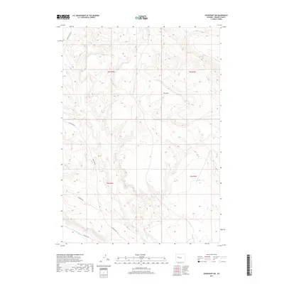
2017 Map of Crowheart NW
USGS Topo · Published 2017About this map
Crow Cr and its surrounding drainage systems define the high-altitude topography of this Fremont County landscape. The network of seasonal watercourses and topographic depressions, such as Ega Draw, suggests a territory managed for range or resource access rather than dense settlement. Human activity is evidenced by a sparse but deliberate road network, including Maverick Springs Rd and Crow Creek Rd, which provide passage through the township and range boundaries of t6n r4w and t5n r4w. In the southern portion of the area, the presence of the Lannigans Ditch indicates early water management efforts to redirect natural flow across the dry terrain, a common feature in Wyoming's high desert agriculture. Modern access routes like Wilderness Dr and Wilderness Rd indicate how newer infrastructure has been laid over the older tracks of this rural ranching region.
Find a feature on this map
11 named features on this map. Tap any name to fly to it.
Don’t see what you’re looking for? This feature index may not catch every label — zoom into the map to look around manually.
Map Details
Editions of this 2017 Crowheart NW Map
This is the sole edition of this map. No revisions or reprints were ever made.
Other maps of this area

1904 · Kirwin
USGS Topo · 1:125,000

1906 · Kirwin
USGS Topo · 1:125,000

1952 · Wilderness
USGS Topo · 1:24,000

1952 · Crowheart Butte
USGS Topo · 1:24,000

1952 · Crowheart NW
USGS Topo · 1:24,000

1952 · Crowheart NE
USGS Topo · 1:24,000

1952 · Crowheart
USGS Topo · 1:24,000

1952 · Burris
USGS Topo · 1:24,000

1955 · Thermopolis
USGS Topo · 1:250,000

1957 · Crowheart NE
USGS Topo · 1:24,000