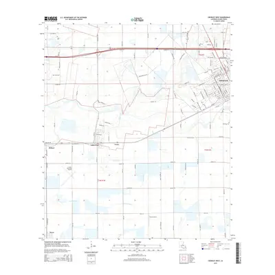
2015 Map of Crowley West
USGS Topo · Published 2015About this map
The western outskirts of Crowley and the surrounding agricultural plains of Acadia Parish define this 2015 survey. The landscape is characterized by an intricate network of waterways and drainage systems, most notably Coulee Triet and the Lazy Point Canal, which serve the region's rice-farming heritage. Smaller settlements like Estherwood, Midland, and Tortue are positioned along the primary east-west transport corridors, while Morse occupies the southern edge of the sheet. Local aviation is represented by Le Gros Memorial Airport and Lejeune Airport, indicating the importance of crop-dusting and regional travel in this part of Louisiana. Genealogists will find interest in localized landmarks such as Leger Cem near the northern boundary and Woodlawn Cem on the eastern edge, along with family-named roads like John Marsh Farm Rd and Ben Sensat Rd that reflect long-standing land ownership patterns in the parish.
Find a feature on this map
111 named features on this map. Tap any name to fly to it.
Don’t see what you’re looking for? This feature index may not catch every label — zoom into the map to look around manually.
Map Details
Editions of this 2015 Crowley West Map
This is the sole edition of this map. No revisions or reprints were ever made.
Other maps of this area

1935 · Branch
USGS Topo · 1:31,680

1946 · Morse
USGS Topo · 1:31,680

1946 · Mermentau
USGS Topo · 1:31,680

1946 · Kaplan
USGS Topo · 1:31,680

1946 · Rayne
USGS Topo · 1:31,680

1947 · Evangeline
USGS Topo · 1:31,680

1947 · Branch
USGS Topo · 1:31,680

1947 · Iota
USGS Topo · 1:31,680

1949 · Gueydan
USGS Topo · 1:31,680

1949 · Estherwood
USGS Topo · 1:31,680