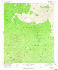
1969 Map of Crown King
USGS Topo · Published 1973About this map
The mining camp of Crown King stands as the central hub of this late-1960s survey, surrounded by a dense network of historic gold and silver claims throughout the Bradshaw Mountains. The landscape is a vertical archive of Arizona mining history, featuring the Gladiator Mine, War Eagle Mine, and the Oro Belle Mine. Beyond active operations, the map documents the passing of the boom era at the Bradshaw City (Site) and nearby Bradshaw City Cem, while the isolated Kentucks Grave and Fort Misery suggest the solitary hardships of early prospectors. Navigated by the winding Senator Highway, the region is dominated by the Prescott National Forest, where recreational sites like Horsethief Basin and Turney Gulch Campground overlap with the older industrial footprint of Juniper Ridge.
Find a feature on this map
104 named features on this map. Tap any name to fly to it.
Don’t see what you’re looking for? This feature index may not catch every label — zoom into the map to look around manually.
Map Details
Editions of this 1969 Crown King Map
4 editions found
Other maps of this area

1887 · Prescott
USGS Topo · 1:250,000

1892 · Prescott
USGS Topo · 1:250,000

1903 · Bradshaw Mountains
USGS Topo · 1:125,000

1947 · Crown King
USGS Topo · 1:62,500

1947 · Bumblebee
USGS Topo · 1:62,500

1947 · Mayer
USGS Topo · 1:62,500

1947 · Mt. Union
USGS Topo · 1:62,500

1948 · Bumblebee
USGS Topo · 1:63,360

1948 · Crown King
USGS Topo · 1:63,360

1948 · Mt. Union
USGS Topo · 1:63,360