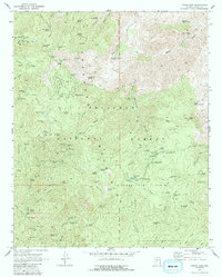
1969 Map of Crown King
USGS Topo · Published 1988About this map
Crown King serves as the focal point for this survey of the southern Bradshaw Mountains, an area deeply marked by its mining history. The landscape is a network of mid-century mining operations including the Gladiator, War Eagle, and Lincoln, connected by historic routes like the Senator Highway. The map captures the transition from active mineral extraction to recreational use within the Prescott National Forest, where campgrounds such as Turney Gulch and Hazlett Hollow are established near the high-elevation peaks.
Find a feature on this map
101 named features on this map. Tap any name to fly to it.
Don’t see what you’re looking for? This feature index may not catch every label — zoom into the map to look around manually.
Map Details
Editions of this 1969 Crown King Map
4 editions found
Other maps of this area

1887 · Prescott
USGS Topo · 1:250,000

1892 · Prescott
USGS Topo · 1:250,000

1903 · Bradshaw Mountains
USGS Topo · 1:125,000

1947 · Crown King
USGS Topo · 1:62,500

1947 · Bumblebee
USGS Topo · 1:62,500

1947 · Mayer
USGS Topo · 1:62,500

1947 · Mt. Union
USGS Topo · 1:62,500

1948 · Bumblebee
USGS Topo · 1:63,360

1948 · Crown King
USGS Topo · 1:63,360

1948 · Mt. Union
USGS Topo · 1:63,360