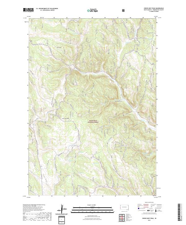
2021 Map of Crows Nest Peak
USGS Topo · Published 2021About this map
Crows Nest Peak stands as the central landmark within this section of the Black Hills National Forest, where a network of Forest Service roads and timber trails crisscross a landscape defined by deep draws and vital water sources. The settlement of Blind Park is situated in the northwest, near Manganese Draw and the headwaters of Castle Creek. This area's geography is heavily shaped by its springs, including Oatman Spring, Miller Spring, and Gillum Spring, which served as essential resources for early settlers and forest management.
Find a feature on this map
74 named features on this map. Tap any name to fly to it.
Don’t see what you’re looking for? This feature index may not catch every label — zoom into the map to look around manually.
Map Details
Editions of this 2021 Crows Nest Peak Map
This is the sole edition of this map. No revisions or reprints were ever made.
Other maps of this area

1894 · Deadwood
USGS Topo · 1:125,000

1896 · Harney Peak
USGS Topo · 1:125,000

1898 · Sundance
USGS Topo · 1:125,000

1899 · Newcastle
USGS Topo · 1:125,000

1901 · Harney Peak
USGS Topo · 1:125,000

1901 · Deadwood
USGS Topo · 1:125,000

1901 · Newcastle
USGS Topo · 1:125,000

1902 · Sundance
USGS Topo · 1:125,000

1916 · Deadwood
USGS Topo · 1:125,000

1953 · Rapid City
USGS Topo · 1:250,000