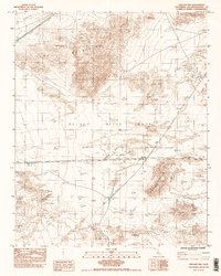
1983 Map of Crucero Hill
USGS Topo · Published 1983About this map
The Crucero rail junction serves as a central landmark in this high-desert landscape, where the Up Rr and Cr&c Rr converge. This 1983 survey captures the complex transport history of the Mojave, showing how modern rails exist alongside an Old RR Grade and a more recent RR Grade. The arid environment is defined by the broad Mojave River Wash, which cuts between the Soda Mountains and the prominent Crucero Hill. Human presence in this demanding terrain is sparse, limited to the isolated Rasor Ranch and the vital water source at Mesquite Spring. The map is particularly revealing for its depiction of flood control and industrial infrastructure, featuring several stretches of Levee and a cross-country Pipeline that traverse the desert floor.
Find a feature on this map
16 named features on this map. Tap any name to fly to it.
Don’t see what you’re looking for? This feature index may not catch every label — zoom into the map to look around manually.
Map Details
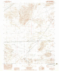
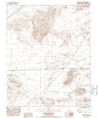
Editions of this 1983 Crucero Hill Map
3 editions found
Other maps of this area

1933 · Avawatz Mountains
USGS Topo · 1:250,000

1947 · Trona
USGS Topo · 1:250,000

1948 · Trona
USGS Topo · 1:250,000

1948 · Cave Mountain
USGS Topo · 1:62,500

1951 · Cave Mountain
USGS Topo · 1:62,500

1953 · San Bernardino
USGS Topo · 1:250,000

1953 · Trona
USGS Topo · 1:250,000

1955 · Cady Mountains
USGS Topo · 1:62,500

1955 · Broadwell Lake
USGS Topo · 1:62,500

1956 · San Bernardino
USGS Topo · 1:250,000