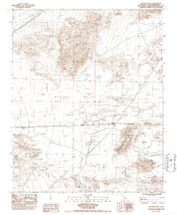
1983 Map of Crucero Hill
USGS Topo · Published 1985About this map
Mojave River Sink and the expansive alkaline flats of Soda Lake dominate this arid landscape at the junction of critical desert transit routes. The tiny settlement of Crucero serves as a focal point where the Union Pacific tracks meet remnants of earlier infrastructure, including an Old RR Grade and a subsequent RR Grade carving through the basin. These corridors reflect the historical necessity of navigating the difficult terrain between the Soda Mountains and Crucero Hill. Scattered signs of desert habitation and water sources appear at Rasor Ranch and Mesquite Spring, while an extensive Levee system north of the sink indicates efforts to manage intermittent desert flooding. The map captures a transition period in the early 1980s where modern rail operations continued alongside the weathering traces of the region's pioneering transportation networks.
Find a feature on this map
15 named features on this map. Tap any name to fly to it.
Don’t see what you’re looking for? This feature index may not catch every label — zoom into the map to look around manually.
Map Details
Editions of this 1983 Crucero Hill Map
3 editions found
Other maps of this area

1933 · Avawatz Mountains
USGS Topo · 1:250,000

1947 · Trona
USGS Topo · 1:250,000

1948 · Trona
USGS Topo · 1:250,000

1948 · Cave Mountain
USGS Topo · 1:62,500

1951 · Cave Mountain
USGS Topo · 1:62,500

1953 · San Bernardino
USGS Topo · 1:250,000

1953 · Trona
USGS Topo · 1:250,000

1955 · Cady Mountains
USGS Topo · 1:62,500

1955 · Broadwell Lake
USGS Topo · 1:62,500

1956 · San Bernardino
USGS Topo · 1:250,000