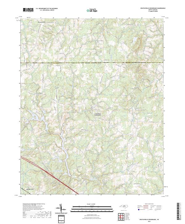
2022 Map of Crutchfield Crossroads
USGS Topo · Published 2022About this map
Rocky River and its various tributaries, including the North Rocky River Prong and Mud Lick Creek, define the rolling drainage patterns of this Chatham County landscape. The southern portion is anchored by the northern edge of Siler City, where the Siler City Water Supply Lake Number Two provides a significant hydrological landmark. This area transition from the concentrated infrastructure near the city to the rural communities of Crutchfield Crossroads and Pleasant Hill further north.
Find a feature on this map
104 named features on this map. Tap any name to fly to it.
Don’t see what you’re looking for? This feature index may not catch every label — zoom into the map to look around manually.
Map Details
Editions of this 2022 Crutchfield Crossroads Map
This is the sole edition of this map. No revisions or reprints were ever made.
Other maps of this area

1953 · Raleigh
USGS Topo · 1:250,000

1954 · Raleigh
USGS Topo · 1:250,000

1968 · Coleridge
USGS Topo · 1:24,000

1969 · Siler City
USGS Topo · 1:24,000

1970 · Kimesville
USGS Topo · 1:24,000

1970 · Siler City NE
USGS Topo · 1:24,000

1974 · Silk Hope
USGS Topo · 1:24,000

1974 · Crutchfield Crossroads
USGS Topo · 1:24,000
1974 · Liberty
USGS Topo · 1:24,000
1977 · Saxapahaw
USGS Topo · 1:24,000