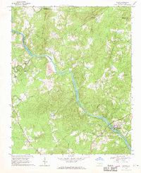
1977 Map of Saxapahaw
USGS Topo · Published 1977About this map
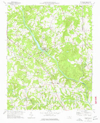
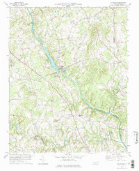
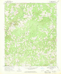
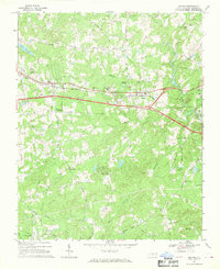
The Haw River carves a dominant path through this portion of the North Carolina Piedmont, serving as the geographic anchor for the milling village of Saxapahaw and the surrounding agricultural communities. By the mid-1970s, the landscape reflects a deeply established network of small settlements and rural spiritual centers, with numerous community landmarks like Maxwell Chapel, St Mathews Chapel, and Salem Ch marking the crossroads. The presence of a Reservoir and Pumping Sta near the river bend indicates the area's role in local water management, while the scattered homes at Eli Whitney and Oaks highlight the persistent rural character of the Alamance and Orange County border. Genealogists will find particular value in the distribution of family-named landmarks and local meeting houses, from Moore Chapel to the southern reach of Cane Creek, which provide clear evidence of late-20th-century settlement patterns before modern suburban expansion.
Find a feature on this map
37 named features on this map. Tap any name to fly to it.
Don’t see what you’re looking for? This feature index may not catch every label — zoom into the map to look around manually.
Map Details
Editions of this 1977 Saxapahaw Map
2 editions found
Other maps of this area

1953 · Raleigh
USGS Topo · 1:250,000

1953 · Greensboro
USGS Topo · 1:250,000

1954 · Greensboro
USGS Topo · 1:250,000

1954 · Raleigh
USGS Topo · 1:250,000

1962 · Greensboro
USGS Topo · 1:250,000

1966 · Greensboro
USGS Topo · 1:250,000
1968 · White Cross
USGS Topo · 1:24,000
1968 · Efland
USGS Topo · 1:24,000
1968 · Bynum
USGS Topo · 1:24,000
1969 · Burlington
USGS Topo · 1:24,000