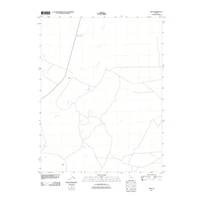
2011 Map of Cruz
USGS Topo · Published 2011About this map
Beaver River meanders through this arid landscape of Millard County, providing a critical water source that defines the surrounding settlement and industry. Near the river's path, the small settlement of Cruz serves as a central point in a region shaped by resource extraction and sparse water management. This area is punctuated by remote landmarks such as Bloom Trail Reservoir and natural water sources like Coyote Spring and Black Spring. The presence of the Cudahy Mine in the southern portion of the quadrangle highlights the historical importance of mining in the Utah desert, where isolated operations were often the primary drivers of local infrastructure and road networks in the early 21st century.
Find a feature on this map
6 named features on this map. Tap any name to fly to it.
Don’t see what you’re looking for? This feature index may not catch every label — zoom into the map to look around manually.
Map Details
Editions of this 2011 Cruz Map
This is the sole edition of this map. No revisions or reprints were ever made.
Other maps of this area

1885 · Beaver
USGS Topo · 1:250,000

1953 · Richfield
USGS Topo · 1:250,000

1958 · Richfield
USGS Topo · 1:250,000

1962 · Tabernacle Hill
USGS Topo · 1:62,500

1962 · Cove Fort
USGS Topo · 1:62,500

1973 · Cruz
USGS Topo · 1:24,000

1973 · Antelope Spring
USGS Topo · 1:24,000
1973 · Borden
USGS Topo · 1:24,000

1973 · Black Rock
USGS Topo · 1:24,000
1973 · Candland Spring
USGS Topo · 1:24,000