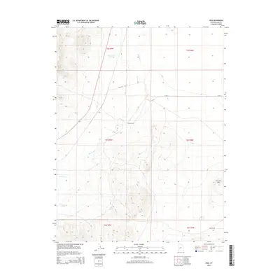
2014 Map of Cruz
USGS Topo · Published 2014About this map
The Cruz settlement sits at the junction of rail and road in this arid stretch of Millard County, where the desert landscape is defined by the ephemeral path of the Beaver River. The terrain transitions from the open valley floor near the Bloom Trail Reservoir to the significant elevation of North Twin Peak in the southeast. This 2014 survey documents the persistence of water sources in a dry climate, noting isolated points like Black Spring and Coyote Spring that have long served as vital landmarks for those traversing the region.
Find a feature on this map
15 named features on this map. Tap any name to fly to it.
Don’t see what you’re looking for? This feature index may not catch every label — zoom into the map to look around manually.
Map Details
Editions of this 2014 Cruz Map
This is the sole edition of this map. No revisions or reprints were ever made.
Other maps of this area

1885 · Beaver
USGS Topo · 1:250,000

1953 · Richfield
USGS Topo · 1:250,000

1958 · Richfield
USGS Topo · 1:250,000

1962 · Tabernacle Hill
USGS Topo · 1:62,500

1962 · Cove Fort
USGS Topo · 1:62,500

1973 · Cruz
USGS Topo · 1:24,000

1973 · Antelope Spring
USGS Topo · 1:24,000
1973 · Borden
USGS Topo · 1:24,000

1973 · Black Rock
USGS Topo · 1:24,000
1973 · Candland Spring
USGS Topo · 1:24,000