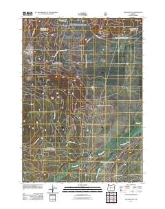
2011 Map of Cryder Butte
USGS Topo · Published 2011About this map
Davis Mountain and Masten Butte anchor the high terrain of this Deschutes County landscape, where a complex network of forest roads serves the timbered interior. The topography is defined by prominent volcanic features like Cryder Butte and Eagle Rock, which overlook a drainage system dominated by the meandering Little Deschutes River. The confluence of Crescent Creek and the river occurs near Kemp Bridge, a key crossing point in the southern portion of the survey area. This 2011 record documents a landscape primarily managed for natural resources, evidenced by the extensive naming of National Forest Development roads such as Nat For Dev RD 6220 and Nat For Dev RD 62. Smaller water features like Little River and the Mayfield Ditch illustrate the local hydrology and early efforts to manage water flow in this high-desert environment.
Find a feature on this map
83 named features on this map. Tap any name to fly to it.
Don’t see what you’re looking for? This feature index may not catch every label — zoom into the map to look around manually.
Map Details
Editions of this 2011 Cryder Butte Map
This is the sole edition of this map. No revisions or reprints were ever made.
Other maps of this area

1930 · Maiden Peak
USGS Topo · 1:125,000

1934 · Maiden Peak
USGS Topo · 1:125,000

1935 · Chemult
USGS Topo · 1:96,000

1941 · Chemult
USGS Topo · 1:125,000

1955 · Crescent
USGS Topo · 1:250,000

1957 · Crescent
USGS Topo · 1:250,000

1958 · Crescent
USGS Topo · 1:250,000

1963 · Hamner Butte
USGS Topo · 1:24,000

1963 · La Pine
USGS Topo · 1:24,000

1963 · Masten Butte
USGS Topo · 1:24,000