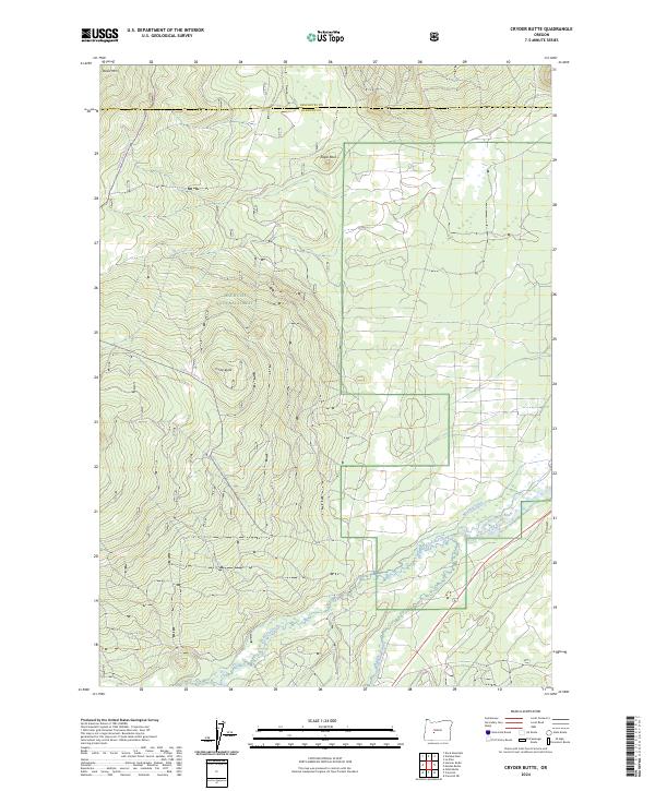
2024 Map of Cryder Butte
USGS Topo · Published 2024About this map
Deschutes National Forest encompasses the vast majority of this high-altitude landscape, where the volcanic topography of the Cascades transition into the basin of the Little Deschutes River. This 2024 survey documents the complex drainage systems and forest routes that define this portion of Klamath County and Deschutes County. Prominent elevations like Davis Mtn, Cryder Butte, and Eagle Rock dominate the skyline, while the southern reaches are marked by the winding course of Crescent Creek and the man-made Mayfield Ditch. The presence of the Gilchrist Express Trl and Hamner-Davis Run Trl indicates a landscape primarily managed for timber, recreation, and water rights, offering a modern view of land use patterns that have shaped this region for decades.
Find a feature on this map
16 named features on this map. Tap any name to fly to it.
Don’t see what you’re looking for? This feature index may not catch every label — zoom into the map to look around manually.
Map Details
Editions of this 2024 Cryder Butte Map
This is the sole edition of this map. No revisions or reprints were ever made.
Other maps of this area

1930 · Maiden Peak
USGS Topo · 1:125,000

1934 · Maiden Peak
USGS Topo · 1:125,000

1935 · Chemult
USGS Topo · 1:96,000

1941 · Chemult
USGS Topo · 1:125,000

1955 · Crescent
USGS Topo · 1:250,000

1957 · Crescent
USGS Topo · 1:250,000

1958 · Crescent
USGS Topo · 1:250,000

1963 · Hamner Butte
USGS Topo · 1:24,000

1963 · La Pine
USGS Topo · 1:24,000

1963 · Masten Butte
USGS Topo · 1:24,000