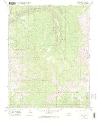
1967 Map of Crystal Creek
USGS Topo · Published 1972About this map
Gunnison National Forest dominates this mountain landscape, defined by the prominent Fossil Ridge and the complex drainage of the Taylor River. In the late 1960s, this area served primarily as a recreational and resource corridor, centered on the Rosy Lane Campground and a network of specialized routes like the Summerville Trail and Fossil Ridge Trail. The high-elevation terrain is marked by seasonal water bodies such as Crystal Lake and numerous drainage systems including Threemile, Fivemile, and Crystal Creek.
Find a feature on this map
29 named features on this map. Tap any name to fly to it.
Don’t see what you’re looking for? This feature index may not catch every label — zoom into the map to look around manually.
Map Details
Editions of this 1967 Crystal Creek Map
3 editions found
Other maps of this area

1888 · Crested Butte
USGS Topo · 1:62,500

1889 · Crested Butte
USGS Topo · 1:62,500

1893 · Crested Butte
USGS Topo · 1:62,500

1934 · Taylor Park
USGS Topo · 1:62,500

1937 · Taylor Park
USGS Topo · 1:62,500

1941 · Pitkin
USGS Topo · 1:62,500

1945 · Pitkin
USGS Topo · 1:62,500

1956 · Montrose
USGS Topo · 1:250,000

1959 · Montrose
USGS Topo · 1:250,000

1960 · Montrose
USGS Topo · 1:250,000