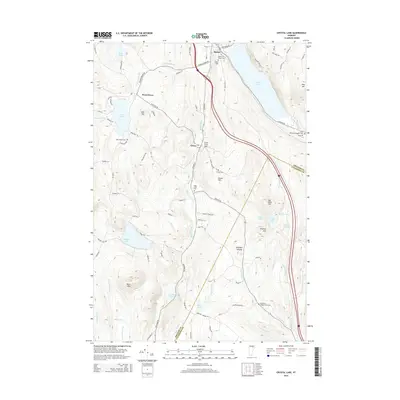
2015 Map of Crystal Lake
USGS Topo · Published 2015About this map
The village of Barton serves as the focal point of this Vermont landscape, situated at the northern tip of Crystal Lake where the Barton River begins its course. This 2015 survey illustrates a rural region defined by its glacial lakes and high ridges, including Lake Parker and Shadow Lake. The terrain is marked by prominent peaks such as Big Rock Hill and Simpson Hill, which rise above the surrounding valleys. A series of small cemeteries, including Welcom O Brown Cem and French Cem, are scattered across the hillsides, reflecting the long-established settlement patterns of Orleans and Caledonia Counties.
Find a feature on this map
94 named features on this map. Tap any name to fly to it.
Don’t see what you’re looking for? This feature index may not catch every label — zoom into the map to look around manually.
Map Details
Editions of this 2015 Crystal Lake Map
This is the sole edition of this map. No revisions or reprints were ever made.
Other maps of this area

1919 · Lake Memphremagog
USGS Topo · 1:62,500

1920 · Derby
USGS Topo · 1:62,500

1920 · Irasburg
USGS Topo · 1:62,500

1923 · Irasburg
USGS Topo · 1:48,000

1923 · Lake Memphremagog
USGS Topo · 1:48,000

1925 · Irasburg
USGS Topo · 1:62,500

1925 · Memphremagog
USGS Topo · 1:62,500

1928 · Hardwick
USGS Topo · 1:62,500

1934 · Hardwick
USGS Topo · 1:48,000

1935 · Lyndonville
USGS Topo · 1:48,000