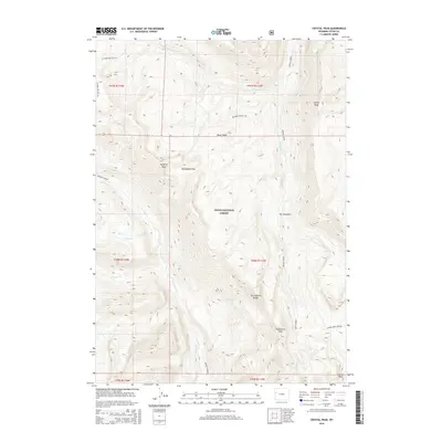
2015 Map of Crystal Peak
USGS Topo · Published 2015About this map
The Gros Ventre Range dominates this portion of the Teton National Forest, defining a landscape of high-elevation peaks and complex drainage networks. Prominent summits including Crystal Peak, Pyramid Peak, and Antoinette Peak anchor the topography, separated by high-altitude crossings like Packsaddle Pass. The map reveals the intricate headwaters of the region, where the W Fork Crystal Cr and Granite Cr begin their descent. A notable ecological pocket is found at The Meadows, a relatively level clearing amidst the steep contour lines. The drainage patterns of Box Cr, feeding from Box Lake, and Bunker Cr illustrate the rugged water-carved environment. This 2015 survey by the U.S. Geological Survey provides a precise view of these remote Wyoming highlands, including the southeastern boundary of the quadrangle near Corner Peak and the Upper Gros Ventre area.
Find a feature on this map
26 named features on this map. Tap any name to fly to it.
Don’t see what you’re looking for? This feature index may not catch every label — zoom into the map to look around manually.
Map Details
Editions of this 2015 Crystal Peak Map
This is the sole edition of this map. No revisions or reprints were ever made.
Other maps of this area

1899 · Grand Teton
USGS Topo · 1:125,000

1901 · Grand Teton
USGS Topo · 1:125,000

1902 · Mt Leidy
USGS Topo · 1:125,000

1907 · Gros Ventre
USGS Topo · 1:125,000

1910 · Gros Ventre
USGS Topo · 1:125,000

1931 · Jackson
USGS Topo · 1:125,000

1935 · Jackson
USGS Topo · 1:125,000

1955 · Driggs
USGS Topo · 1:250,000

1958 · Driggs
USGS Topo · 1:250,000

1962 · Driggs
USGS Topo · 1:250,000