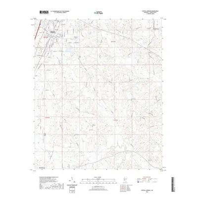
2020 Map of Crystal Springs
USGS Topo · Published 2020About this map
Crystal Springs serves as the primary hub of this Copiah County landscape, where the residential grid meets the regional transport network near Chautauqua Lake. The surrounding terrain is defined by the winding paths of Little Copiah Creek and Brushy Creek, which drain a landscape dotted with numerous historic burial grounds. These sites, including Poplar Springs Cem, Saint Paul Cem, and Red Bone Cem, provide essential anchor points for genealogical research across the rural outskirts. Transport and infrastructure are represented by both the Copiah County Airport and the smaller Wells Farm Airport, alongside a dense network of secondary roads such as Brushy Creek Rd and Six Mile Rd. The map also captures the northern edge of Hazlehurst, showing the transition between these two established Mississippi communities.
Find a feature on this map
94 named features on this map. Tap any name to fly to it.
Don’t see what you’re looking for? This feature index may not catch every label — zoom into the map to look around manually.
Map Details
Editions of this 2020 Crystal Springs Map
This is the sole edition of this map. No revisions or reprints were ever made.
Other maps of this area

1903 · Jackson
USGS Topo · 1:125,000

1906 · Florence
USGS Topo · 1:62,500

1908 · Florence
USGS Topo · 1:62,500

1937 · Terry
USGS Topo · 1:48,000

1943 · Terry
USGS Topo · 1:62,500

1953 · Natchez
USGS Topo · 1:250,000

1955 · Jackson
USGS Topo · 1:250,000

1956 · Natchez
USGS Topo · 1:250,000

1959 · Natchez
USGS Topo · 1:250,000

1961 · Jackson
USGS Topo · 1:250,000