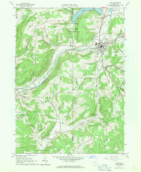
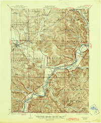
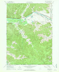
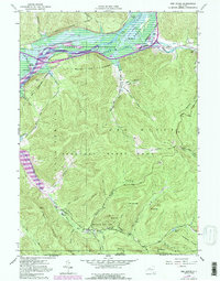
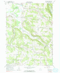
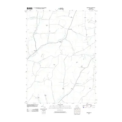
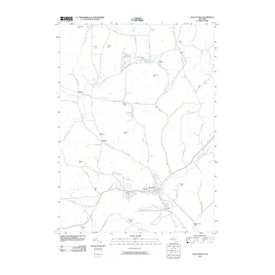
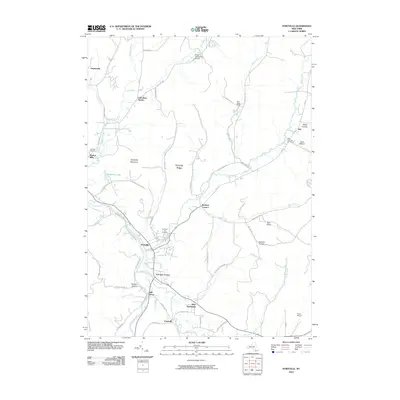
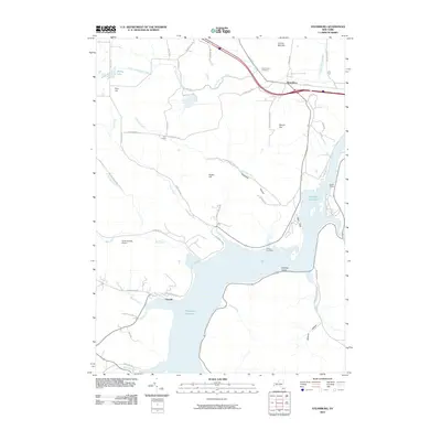
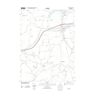
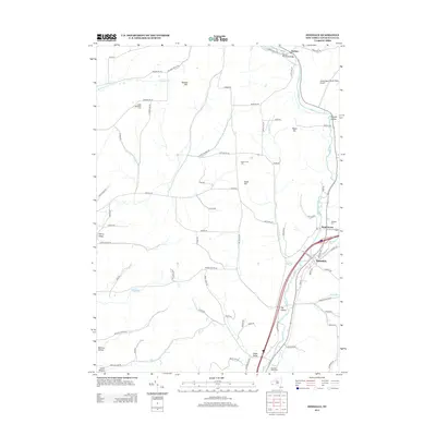
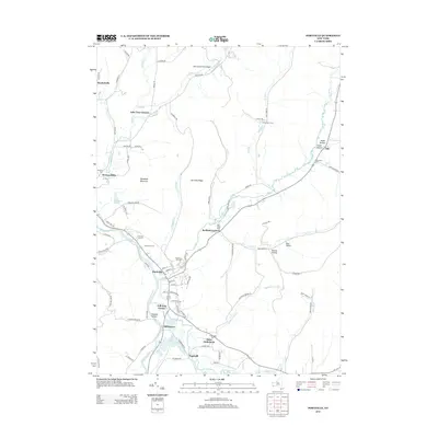
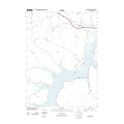
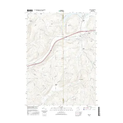
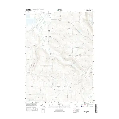
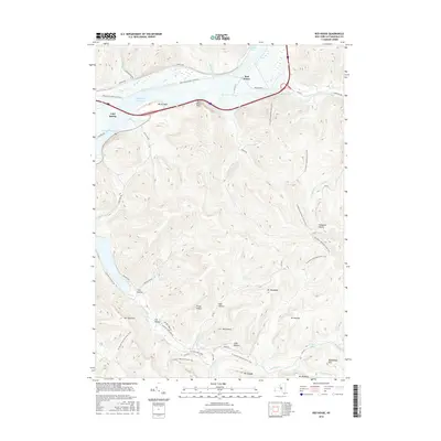
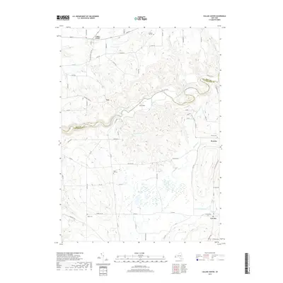
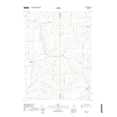
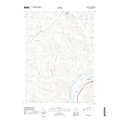
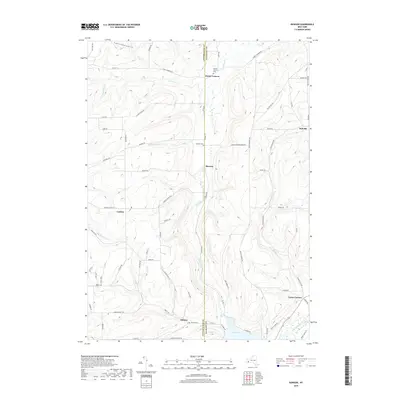
1961 Map of Cuba
USGS Topo · Published 1971About this map
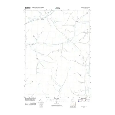
The Oil Spring Indian Reservation sits at the heart of this landscape, centered around the historic Oil Spring and the waters of Cuba Lake. This 1961 survey documents a transition in Western New York, where the village of Cuba serves as a transportation hub for the Erie-Lackawanna and Pennsylvania railroads. The map records the industrial and civic footprint of the era, from the Tannery and Filtration Plant near the village center to the Olean Municipal Airport on the western heights of Hatch Hill. Rural life is detailed through small clusters like North Cuba, South Cuba, and Haskell Flats. Geologists and historians will find evidence of the region's early resource extraction, noting numerous Gas Wells and the remnants of the Little Genesee Valley Canal tracing the path of Oil Creek.
Find a feature on this map
65 named features on this map. Tap any name to fly to it.
Don’t see what you’re looking for? This feature index may not catch every label — zoom into the map to look around manually.
Map Details
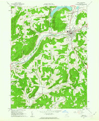
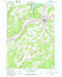
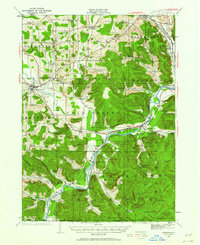
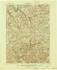
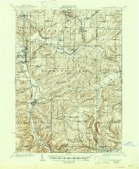
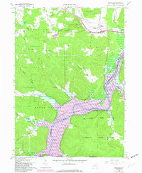
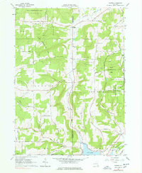
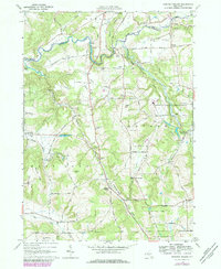
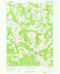
Editions of this 1961 Cuba Map
4 editions found
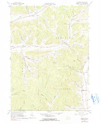
Historical Maps of Portville Through Time
112 maps found
1922 Randolph
Cattaraugus County, NY
1923 Randolph
Cattaraugus County, NY
1924 Ellicottville
Cattaraugus County, NY
1924 Franklinville
Cattaraugus County, NY

1941 Ellicottville
Cattaraugus County, NY

1942 Franklinville
Cattaraugus County, NY

1943 Randolph
Cattaraugus County, NY

1961 Cuba
Cattaraugus County, NY

1961 Hinsdale
Cattaraugus County, NY
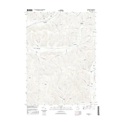
1961 Humphrey
Cattaraugus County, NY
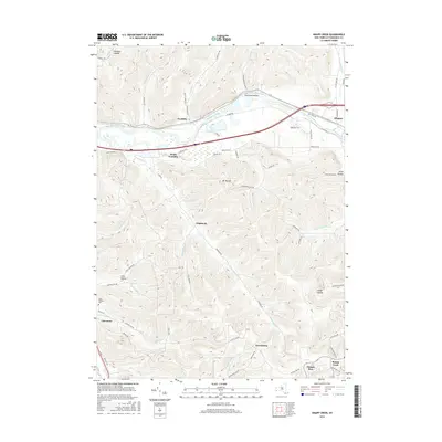
1961 Knapp Creek
Cattaraugus County, NY
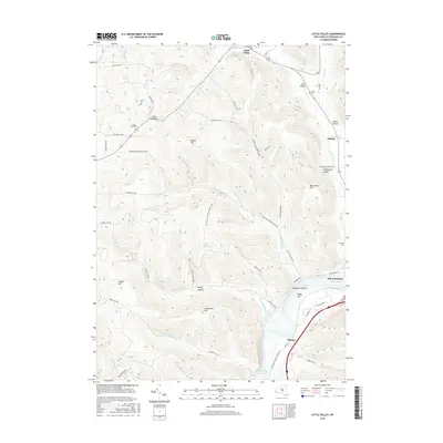
1961 Portville
Cattaraugus County, NY
1962 Little Valley
Cattaraugus County, NY
1962 Randolph
Cattaraugus County, NY
1962 Red House
Cattaraugus County, NY
1962 Steamburg
Cattaraugus County, NY
1963 Collins Center
Cattaraugus County, NY

1963 Franklinville
Cattaraugus County, NY
1963 Freedom
Cattaraugus County, NY
1963 New Albion
Cattaraugus County, NY
1963 Rawson
Cattaraugus County, NY

1964 Ashford
Cattaraugus County, NY
1964 Ashford Hollow
Cattaraugus County, NY
1964 Ellicottville
Cattaraugus County, NY

1971 Hinsdale
Cattaraugus County, NY

1979 Hinsdale
Cattaraugus County, NY

1979 Knapp Creek
Cattaraugus County, NY
2010 Ashford
Cattaraugus County, NY
2010 Ashford Hollow
Cattaraugus County, NY
2010 Collins Center
Cattaraugus County, NY
2010 Cuba
Cattaraugus County, NY
2010 Ellicottville
Cattaraugus County, NY
2010 Franklinville
Cattaraugus County, NY
2010 Freedom
Cattaraugus County, NY
2010 Hinsdale
Cattaraugus County, NY
2010 Humphrey
Cattaraugus County, NY
2010 Knapp Creek
Cattaraugus County, NY
2010 Little Valley
Cattaraugus County, NY
2010 New Albion
Cattaraugus County, NY
2010 Portville
Cattaraugus County, NY
2010 Randolph
Cattaraugus County, NY
2010 Rawson
Cattaraugus County, NY
2010 Red House
Cattaraugus County, NY
2010 Steamburg
Cattaraugus County, NY
2013 Ashford
Cattaraugus County, NY
2013 Ashford Hollow
Cattaraugus County, NY
2013 Collins Center
Cattaraugus County, NY
2013 Cuba
Cattaraugus County, NY
2013 Ellicottville
Cattaraugus County, NY
2013 Franklinville
Cattaraugus County, NY
2013 Freedom
Cattaraugus County, NY
2013 Hinsdale
Cattaraugus County, NY
2013 Humphrey
Cattaraugus County, NY
2013 Knapp Creek
Cattaraugus County, NY
2013 Little Valley
Cattaraugus County, NY

2013 New Albion
Cattaraugus County, NY
2013 Portville
Cattaraugus County, NY
2013 Randolph
Cattaraugus County, NY
2013 Rawson
Cattaraugus County, NY
2013 Red House
Cattaraugus County, NY
2013 Steamburg
Cattaraugus County, NY
2016 Ashford
Cattaraugus County, NY
2016 Ashford Hollow
Cattaraugus County, NY
2016 Collins Center
Cattaraugus County, NY
2016 Cuba
Cattaraugus County, NY
2016 Ellicottville
Cattaraugus County, NY
2016 Franklinville
Cattaraugus County, NY
2016 Freedom
Cattaraugus County, NY
2016 Hinsdale
Cattaraugus County, NY
2016 Humphrey
Cattaraugus County, NY
2016 Knapp Creek
Cattaraugus County, NY
2016 Little Valley
Cattaraugus County, NY
2016 New Albion
Cattaraugus County, NY
2016 Portville
Cattaraugus County, NY
2016 Randolph
Cattaraugus County, NY
2016 Rawson
Cattaraugus County, NY
2016 Red House
Cattaraugus County, NY
2016 Steamburg
Cattaraugus County, NY
2019 Ashford
Cattaraugus County, NY
2019 Ashford Hollow
Cattaraugus County, NY
2019 Collins Center
Cattaraugus County, NY
2019 Cuba
Cattaraugus County, NY
2019 Ellicottville
Cattaraugus County, NY
2019 Franklinville
Cattaraugus County, NY
2019 Freedom
Cattaraugus County, NY
2019 Hinsdale
Cattaraugus County, NY
2019 Humphrey
Cattaraugus County, NY
2019 Knapp Creek
Cattaraugus County, NY
2019 Little Valley
Cattaraugus County, NY
2019 New Albion
Cattaraugus County, NY
2019 Portville
Cattaraugus County, NY
2019 Randolph
Cattaraugus County, NY
2019 Rawson
Cattaraugus County, NY
2019 Red House
Cattaraugus County, NY
2019 Steamburg
Cattaraugus County, NY

2023 Ashford
Cattaraugus County, NY

2023 Ashford Hollow
Cattaraugus County, NY

2023 Collins Center
Cattaraugus County, NY

2023 Cuba
Cattaraugus County, NY

2023 Ellicottville
Cattaraugus County, NY

2023 Franklinville
Cattaraugus County, NY

2023 Freedom
Cattaraugus County, NY

2023 Hinsdale
Cattaraugus County, NY

2023 Humphrey
Cattaraugus County, NY

2023 Knapp Creek
Cattaraugus County, NY

2023 Little Valley
Cattaraugus County, NY

2023 New Albion
Cattaraugus County, NY

2023 Portville
Cattaraugus County, NY

2023 Randolph
Cattaraugus County, NY

2023 Rawson
Cattaraugus County, NY

2023 Red House
Cattaraugus County, NY

2023 Steamburg
Cattaraugus County, NY