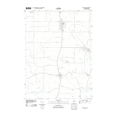
2010 Map of Cuba City
USGS Topo · Published 2010About this map
Cuba City serves as a central hub in this Grant County landscape, where the street grids of Benton and Hazel Green also punctuate a largely agricultural expanse. The area's legacy of extraction is visible through several named operations, including the Burkett Mine, Unity Mine, and Northwestern Mine, indicating the historical significance of the lead and zinc mining industry that shaped this portion of southwest Wisconsin. Waterways like the Sinsinawa River and the Galena River drain the terrain, accompanied by numerous smaller tributaries such as Coon Branch and Scrabble Branch. The map preserves local historical waypoints such as Mount Pleasant Cemetery and Leslie Cemetery, alongside small communities like Saint Rose and Georgetown. The road network is dense with family-named routes and functional connectors, including Slaats Rd, Kirkwood Rd, and Carr Factory Rd, reflecting generations of land ownership and local commerce.
Find a feature on this map
53 named features on this map. Tap any name to fly to it.
Don’t see what you’re looking for? This feature index may not catch every label — zoom into the map to look around manually.
Map Details
Editions of this 2010 Cuba City Map
This is the sole edition of this map. No revisions or reprints were ever made.
Other maps of this area

1900 · Lancaster
USGS Topo · 1:125,000

1901 · Peosta
USGS Topo · 1:125,000

1902 · Mineral Point
USGS Topo · 1:125,000

1904 · Lancaster
USGS Topo · 1:125,000

1908 · Lancaster
USGS Topo · 1:125,000

1911 · Galena
USGS Topo · 1:62,500

1913 · Galena
USGS Topo · 1:62,500

1935 · East Dubuque
USGS Topo · 1:62,500

1940 · East Dubuque
USGS Topo · 1:62,500

1952 · Platteville
USGS Topo · 1:24,000