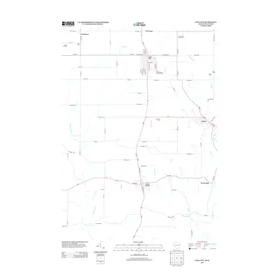
2013 Map of Cuba City
USGS Topo · Published 2013About this map
Cuba City serves as a central hub in this section of southwestern Wisconsin, where the agricultural landscape is defined by family-run operations such as the Kaiser Dairy and Hog Farm and Kisting Farm. The terrain is deeply etched by a network of waterways including the Galena River and the Sinsinawa River, which dictate the winding paths of rural routes like Sinsinawa Rd and Kirkwood Rd. Smaller communities and named locales like Benton, Hazel Green, and the settlement of Strawbridge are connected by these drainage patterns and a grid of township roads.
Find a feature on this map
77 named features on this map. Tap any name to fly to it.
Don’t see what you’re looking for? This feature index may not catch every label — zoom into the map to look around manually.
Map Details
Editions of this 2013 Cuba City Map
This is the sole edition of this map. No revisions or reprints were ever made.
Other maps of this area

1900 · Lancaster
USGS Topo · 1:125,000

1901 · Peosta
USGS Topo · 1:125,000

1902 · Mineral Point
USGS Topo · 1:125,000

1904 · Lancaster
USGS Topo · 1:125,000

1908 · Lancaster
USGS Topo · 1:125,000

1911 · Galena
USGS Topo · 1:62,500

1913 · Galena
USGS Topo · 1:62,500

1935 · East Dubuque
USGS Topo · 1:62,500

1940 · East Dubuque
USGS Topo · 1:62,500

1952 · Platteville
USGS Topo · 1:24,000