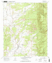
1963 Map of Cuba
USGS Topo · Published 1975About this map
Cuba serves as the primary hub in this high-desert landscape, situated where the Rito and Nacimiento Creek meet. The settlement pattern follows the drainage of the San Jose, with established communities like La Jara and Upper La Jara dotting the northern reaches. This 1963 survey reveals the essential infrastructure of rural New Mexico life, from the Santos Niños Ch and La Jara Sch to the Rodeo Ground south of the main town site.
Find a feature on this map
38 named features on this map. Tap any name to fly to it.
Don’t see what you’re looking for? This feature index may not catch every label — zoom into the map to look around manually.
Map Details
Editions of this 1963 Cuba Map
3 editions found
Other maps of this area

1883 · Mt. Taylor
USGS Topo · 1:250,000

1886 · Mt. Taylor
USGS Topo · 1:250,000

1889 · Largo
USGS Topo · 1:250,000

1890 · Jemes
USGS Topo · 1:125,000

1892 · Jemes
USGS Topo · 1:125,000

1892 · Mt. Taylor
USGS Topo · 1:250,000

1895 · Largo
USGS Topo · 1:250,000

1899 · Mt. Taylor
USGS Topo · 1:250,000

1909 · Gallina
USGS Topo · 1:125,000

1939 · La Ventana
USGS Topo · 1:62,500