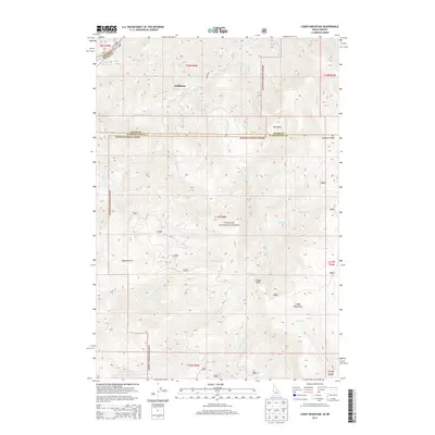
2013 Map of Cuddy Mountain
USGS Topo · Published 2013About this map
Wildhorse serves as a lone named outpost in this high-elevation Idaho-Oregon borderlands region, situated just east of the Oxbow Reservoir on the Wildhorse River. The landscape is dominated by the steep rises of the Cuddy Mountains, reaching a high point at Cuddy Mtn, and much of the area falls within the management of the Payette National Forest. This 2013 survey illustrates a transition from the deep waters of the Snake River canyon to the high, forested plateaus and basins typical of the Pacific Northwest's interior.
Find a feature on this map
34 named features on this map. Tap any name to fly to it.
Don’t see what you’re looking for? This feature index may not catch every label — zoom into the map to look around manually.
Map Details
Editions of this 2013 Cuddy Mountain Map
This is the sole edition of this map. No revisions or reprints were ever made.
Other maps of this area

1955 · Baker
USGS Topo · 1:250,000

1957 · Cambridge
USGS Topo · 1:62,500

1957 · Copperfield
USGS Topo · 1:62,500

1957 · Hornet
USGS Topo · 1:62,500

1957 · Sturgill Peak
USGS Topo · 1:62,500

1959 · Baker
USGS Topo · 1:250,000

1980 · McCall
USGS Topo · 1:100,000
1986 · Crooked River Point
USGS Topo · 1:24,000
1986 · Rocky Comfort Flat
USGS Topo · 1:24,000
1986 · Rush Peak
USGS Topo · 1:24,000