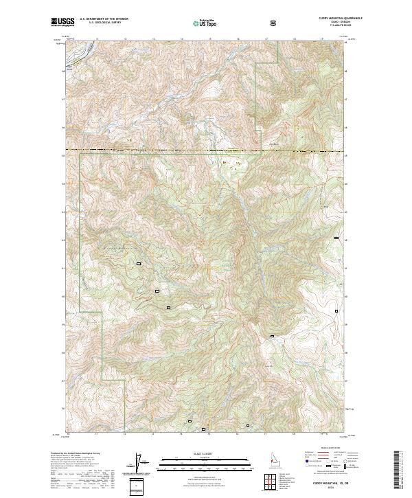
2024 Map of Cuddy Mountain
USGS Topo · Published 2024About this map
Payette National Forest dominates this high-elevation landscape, where the Cuddy Mountains rise above the drainage of the Wildhorse River. The terrain is defined by a dense network of forest service routes and pack trails, such as the Grizzly Creek Trl and the Dukes Creek Starveout Creek Trl, which connect remote basins like Lost Basin.
Find a feature on this map
46 named features on this map. Tap any name to fly to it.
Don’t see what you’re looking for? This feature index may not catch every label — zoom into the map to look around manually.
Map Details
Editions of this 2024 Cuddy Mountain Map
This is the sole edition of this map. No revisions or reprints were ever made.
Other maps of this area

1955 · Baker
USGS Topo · 1:250,000

1957 · Cambridge
USGS Topo · 1:62,500

1957 · Copperfield
USGS Topo · 1:62,500

1957 · Hornet
USGS Topo · 1:62,500

1957 · Sturgill Peak
USGS Topo · 1:62,500

1959 · Baker
USGS Topo · 1:250,000

1980 · McCall
USGS Topo · 1:100,000
1986 · Crooked River Point
USGS Topo · 1:24,000
1986 · Rocky Comfort Flat
USGS Topo · 1:24,000
1986 · Rush Peak
USGS Topo · 1:24,000