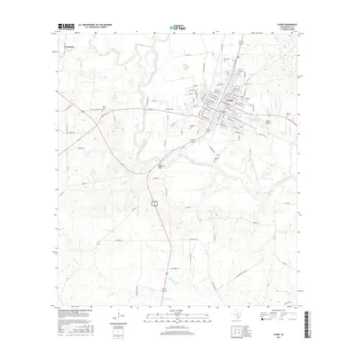
2016 Map of Cuero
USGS Topo · Published 2016About this map
The Guadalupe River carves a serpentine path through DeWitt County, serving as the central geographic feature for the city of Cuero. In this mid-2010s survey, the urban street grid of Cuero is shown in detail, extending east toward the Cuero Municipal Airport and the waters of City of Cuero Lake. The surrounding landscape is defined by a dense network of ranch roads and rural routes, including Old San Antonio Rd and Old Goliad Rd, which speak to the area's long-standing importance as a regional transit corridor. Genealogists will find a high density of burial sites documented across the quadrangle, from the large Evergreen Cem in town to rural locations like McCrabb Cem, Lost Creek Cem, and Woodman Cem. Small outlying communities such as Lindenau remain connected to the county seat via local thoroughfares like Lindenau Rd and FM 953.
Find a feature on this map
122 named features on this map. Tap any name to fly to it.
Don’t see what you’re looking for? This feature index may not catch every label — zoom into the map to look around manually.
Map Details
Editions of this 2016 Cuero Map
This is the sole edition of this map. No revisions or reprints were ever made.
Other maps of this area

1953 · Beeville
USGS Topo · 1:250,000

1953 · Seguin
USGS Topo · 1:250,000

1956 · Beeville
USGS Topo · 1:250,000

1958 · Seguin
USGS Topo · 1:250,000

1960 · Beeville
USGS Topo · 1:250,000

1960 · Cuero
USGS Topo · 1:24,000

1960 · Concrete
USGS Topo · 1:24,000

1960 · Blackwell Lake
USGS Topo · 1:24,000

1960 · Westhoff
USGS Topo · 1:24,000

1962 · Verhelle
USGS Topo · 1:24,000