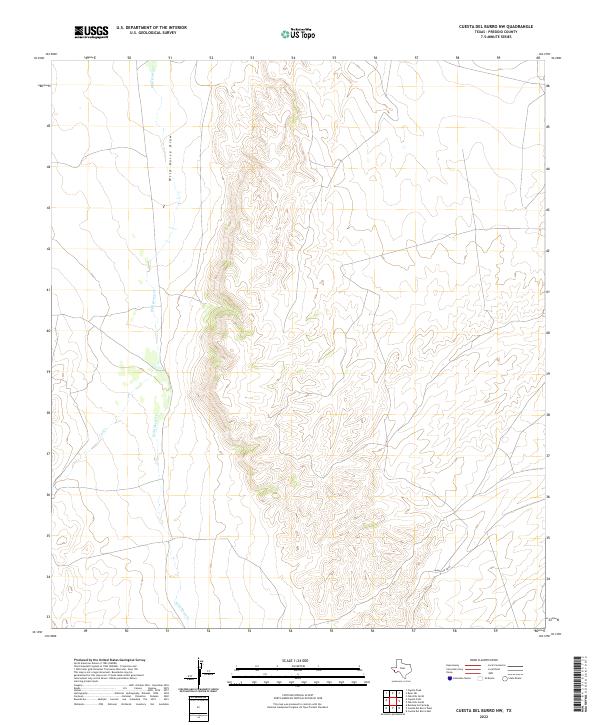
2022 Map of Cuesta Del Burro NW
USGS Topo · Published 2022About this map
Wild Horse Cr and Wild Horse Draw define the central drainage system of this arid Presidio County landscape. The topography is dominated by the steep escarpments and intricate ridgelines characteristic of the West Texas high desert, where water features are seasonal but structurally significant to the landform. Modern infrastructure is limited to Ranch Rd 2810, which skirts the southern portion of the area, providing one of the few points of access through this part of the Chihuahuan Desert. The map serves as a detailed study of natural drainage patterns, including the path of Cat Cr, showing how water has carved the terrain over time in this sparsely populated region of the Trans-Pecos.
Find a feature on this map
4 named features on this map. Tap any name to fly to it.
Don’t see what you’re looking for? This feature index may not catch every label — zoom into the map to look around manually.
Map Details
Editions of this 2022 Cuesta Del Burro NW Map
This is the sole edition of this map. No revisions or reprints were ever made.
Other maps of this area

1895 · Marfa
USGS Topo · 1:125,000

1896 · San Carlos
USGS Topo · 1:125,000

1959 · Marfa
USGS Topo · 1:250,000

1965 · Marfa
USGS Topo · 1:250,000
1978 · Capote Peak
USGS Topo · 1:24,000

1979 · Ruidosa Hot Springs
USGS Topo · 1:24,000

1979 · Capote Falls
USGS Topo · 1:24,000

1983 · Cuesta Del Burro East
USGS Topo · 1:24,000
1983 · Cuesta Del Burro NW
USGS Topo · 1:24,000
1983 · Cuesta Del Burro West
USGS Topo · 1:24,000