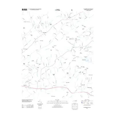
2013 Map of Culberson
USGS Topo · Published 2013About this map
Culberson sits at the northern edge of this North Carolina and Georgia borderland, where the legacy of a mountain milling economy is written across the landscape. The proliferation of small settlements such as Thomas Mill, Bryan Mill, Lance Mill, and Sparks Mill suggests a history of localized industry tied to the region's many watercourses, including Hemptown Cr and Owenby Cr. To the east, the Robert W Woodruff Scout Reservation surrounds Lake Woodruff, preserving a large tract of the Blue Ridge foothills. The southern portion of the map is defined by the corridor of Old US Hwy 76 passing through Hemp, while the terrain rises sharply into prominent features like Watson Mountain and Richards Mountain. This survey documents a quiet rural area where family-named landmarks like Raper Knob and Davenport Knob indicate long-standing ties to the land.
Find a feature on this map
79 named features on this map. Tap any name to fly to it.
Don’t see what you’re looking for? This feature index may not catch every label — zoom into the map to look around manually.
Map Details
Editions of this 2013 Culberson Map
This is the sole edition of this map. No revisions or reprints were ever made.
Other maps of this area

1888 · Ellijay
USGS Topo · 1:125,000

1892 · Ellijay
USGS Topo · 1:125,000

1893 · Murphy
USGS Topo · 1:125,000

1898 · Ellijay
USGS Topo · 1:125,000

1911 · Ellijay
USGS Topo · 1:125,000

1914 · Murphy
USGS Topo · 1:125,000

1934 · Murphy
USGS Topo · 1:24,000

1934 · Persimmon Creek
USGS Topo · 1:24,000

1934 · Murphy
USGS Topo · 1:48,000

1935 · Ivylog
USGS Topo · 1:24,000