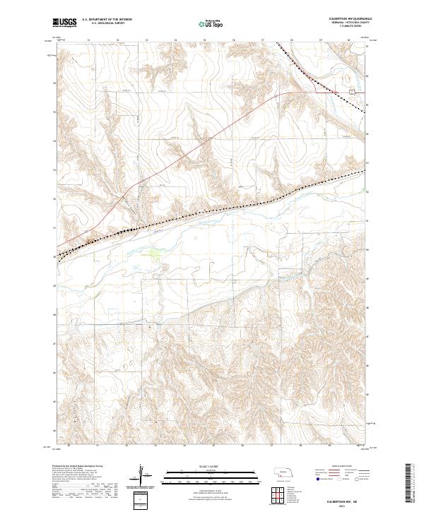
2021 Map of Culbertson NW
USGS Topo · Published 2021About this map
Republican River dominates this Hitchcock County landscape, carving a wide valley across the central portion of the sheet. The river is flanked by an extensive irrigation network, including the Riverside Canal and Upper Meeker Canal, which support agriculture in this semi-arid region. North of the river, Massacre Canyon cuts through the uplands, serving as a prominent geographical landmark with deep historical resonance for the plains. The terrain transitions from these high, dissected bluffs down to the alluvial floor where Frenchman Creek joins the valley system. Modern infrastructure is represented by routes like Old Hwy 34 and N River Dr, which trace the natural contours of the river valley. The map also detail southern drainages such as Thompson Canyon and Big Canyon, illustrating the complex erosion patterns that define the Nebraska panhandle periphery.
Find a feature on this map
24 named features on this map. Tap any name to fly to it.
Don’t see what you’re looking for? This feature index may not catch every label — zoom into the map to look around manually.
Map Details
Editions of this 2021 Culbertson NW Map
This is the sole edition of this map. No revisions or reprints were ever made.
Other maps of this area

1954 · McCook
USGS Topo · 1:250,000

1957 · McCook
USGS Topo · 1:250,000

1958 · McCook
USGS Topo · 1:250,000

1962 · Trenton
USGS Topo · 1:24,000

1962 · Culbertson NW
USGS Topo · 1:24,000

1962 · Culbertson SW
USGS Topo · 1:24,000
1962 · Trenton SE
USGS Topo · 1:24,000
1970 · Culbertson
USGS Topo · 1:24,000

1970 · Burger Canyon SE
USGS Topo · 1:24,000
1970 · Culbertson SE
USGS Topo · 1:24,000