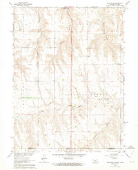
1962 Map of Trenton SE
USGS Topo · Published 1964About this map
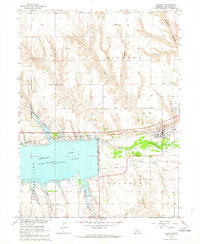
Swanson Lake anchors the northern edge of this early 1960s survey, marking a significant landscape of controlled inundation and water management in the Missouri River Basin. The terrain is defined by a series of deeply etched drainages, including Jones Canyon, Spring Canyon, and Wildhorse Canyon, which cut through the high plains toward the Driftwood Creek system. This area, spanning the Nebraska Kansas Base Line, shows a rural economy transitioning between traditional agriculture and early energy exploration, evidenced by several Oil Wells scattered across the uplands.
Find a feature on this map
17 named features on this map. Tap any name to fly to it.
Don’t see what you’re looking for? This feature index may not catch every label — zoom into the map to look around manually.
Map Details
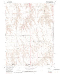
Editions of this 1962 Trenton SE Map
2 editions found
Other maps of this area
1951 · Herndon
USGS Topo · 1:62,500
1951 · Atwood
USGS Topo · 1:62,500

1954 · McCook
USGS Topo · 1:250,000

1954 · Goodland
USGS Topo · 1:250,000

1956 · Goodland
USGS Topo · 1:250,000

1957 · McCook
USGS Topo · 1:250,000

1957 · Goodland
USGS Topo · 1:250,000

1958 · McCook
USGS Topo · 1:250,000
1962 · Trenton
USGS Topo · 1:24,000
1962 · Trenton SW
USGS Topo · 1:24,000